Guided reading
Sea level is rising 3.4 mm per year, and under a 2℃ scenario 3.29 percent of Tainan would be flooded. The Provincial Highway 61 controversy now has an added layer: its bridge piers land on the southernmost habitat of the Formosan fiddler crab in Taiwan.R001SourceCompilation of climate change data (sea level around Taiwan rising at twice the global average, about 3.4 mm per year over the past 20 years; rises of 0.5/1.2 m under 2℃/4℃ warming scenarios; under the 2℃ scenario, 3.29% of Tainan City's area flooded with a maximum depth of 1.5–2.0 m; another assessment finds the affected area largest in Tainan, at 426 km²)Original URLhttps://www.ncdr.nat.gov.tw/Retrieved2026-10-18Snapshot timestamp(None, or not applicable)The National Science and Technology Center for Disaster Reduction (國家災害防救科技中心) runs an online system, 「氣候變遷情境下海平面上升溢淹風險評估」 ["Assessment of Flooding Risk from Sea-Level Rise under Climate Change Scenarios"]; 《國家氣候變遷科學報告 2024》[National Climate Change Science Report 2024] has a dedicated chapter on coasts.
- Time span
- 1992–202634 years
- Current status
- In early ROC year 110 the Taijiang National Park Headquarters said the Provincial Highway 61 bridge over the Zengwen River "may start construction this year or next" R004Source《109-110 年度曾文溪口重要濕地(國際級)生態及水質基礎調查計畫》[2020–2021 Baseline Survey of Ecology and Water Quality of the Zengwen River Estuary Wetland of Importance (International Level)], NCKU Research and Development Foundation (成大研究發展基金會), co-principal investigator Liu Ching-yu (劉靜榆), July 2021 (ROC year 110) (the piers of the Provincial Highway 61 bridge across the Zengwen River land right on the Qingcaolun mudflat, near census site E; three statements by the Taijiang National Park Headquarters: the purpose of the project is to establish baseline data before construction begins, the pier sites should be on the mudflat with no construction access road, and construction may begin this year or next; Recommendation 3 requires that the effect of nighttime streetlights on wildlife be taken into account; printed pp. 78, 80, 83, 98, 101–102)Original URLhttps://www.tjnp.gov.tw/Retrieved2026-10-19Snapshot timestamp—, and scheduled a follow-up study, the "111–112 Survey of Ecology and Biodiversity on the Qingcaolun Mudflat, South Bank (Construction Impact)" R006SourceOfficial title of the follow-up project: 《111-112 年 南岸青草崙灘地生態及生物多樣性物種調查(工程衝擊影響)》[2022–2023 Survey of the Ecology and Biodiversity of the South-Bank Qingcaolun Mudflat (Construction Impacts)], commissioning agencies the Taijiang National Park Headquarters (台江國家公園管理處) and the Agriculture Bureau, Tainan City Government (臺南市政府農業局) (Recommendation 6, printed p. 84)Original URLhttps://www.tjnp.gov.tw/Retrieved2026-10-19Snapshot timestamp—Commissioned research reports; the latest year available is 2020–2021 (ROC years 109–110)..
- Key figures
- about 3.4 mm a year (twice the global average)Sea-level rise around TaiwanR001SourceCompilation of climate change data (sea level around Taiwan rising at twice the global average, about 3.4 mm per year over the past 20 years; rises of 0.5/1.2 m under 2℃/4℃ warming scenarios; under the 2℃ scenario, 3.29% of Tainan City's area flooded with a maximum depth of 1.5–2.0 m; another assessment finds the affected area largest in Tainan, at 426 km²)Original URLhttps://www.ncdr.nat.gov.tw/Retrieved2026-10-18Snapshot timestamp(None, or not applicable)The National Science and Technology Center for Disaster Reduction (國家災害防救科技中心) runs an online system, 「氣候變遷情境下海平面上升溢淹風險評估」 ["Assessment of Flooding Risk from Sea-Level Rise under Climate Change Scenarios"]; 《國家氣候變遷科學報告 2024》[National Climate Change Science Report 2024] has a dedicated chapter on coasts.
- 3.29% (up to 1.5–2.0 m deep)Share of Tainan flooded under 2℃ of warmingR001SourceCompilation of climate change data (sea level around Taiwan rising at twice the global average, about 3.4 mm per year over the past 20 years; rises of 0.5/1.2 m under 2℃/4℃ warming scenarios; under the 2℃ scenario, 3.29% of Tainan City's area flooded with a maximum depth of 1.5–2.0 m; another assessment finds the affected area largest in Tainan, at 426 km²)Original URLhttps://www.ncdr.nat.gov.tw/Retrieved2026-10-18Snapshot timestamp(None, or not applicable)The National Science and Technology Center for Disaster Reduction (國家災害防救科技中心) runs an online system, 「氣候變遷情境下海平面上升溢淹風險評估」 ["Assessment of Flooding Risk from Sea-Level Rise under Climate Change Scenarios"]; 《國家氣候變遷科學報告 2024》[National Climate Change Science Report 2024] has a dedicated chapter on coasts.
- about 747 m (outside)Distance from the Highway 61 pier site (point E) to the national park zoning boundaryR005SourceDetermination from the Taijiang National Park zoning vector data (the 「國家公園土地使用分區」[National Park Land Use Zoning] layer of the National Spatial Planning GIS Platform of the 內政部國土管理署 [National Land Management Agency, Ministry of the Interior]; site E = the Provincial Highway 61 pier site, 747 m outside the zoning boundary; water-quality station St.4, 628 m outside)Original URLhttps://nspi.nlma.gov.tw/Retrieved2026-10-20Snapshot timestamp(None, or not applicable)
- Evidence mix
Why it matters
As sea levels rise, Tainan's coastal sandbars, fish ponds and lowlands flood first R001SourceCompilation of climate change data (sea level around Taiwan rising at twice the global average, about 3.4 mm per year over the past 20 years; rises of 0.5/1.2 m under 2℃/4℃ warming scenarios; under the 2℃ scenario, 3.29% of Tainan City's area flooded with a maximum depth of 1.5–2.0 m; another assessment finds the affected area largest in Tainan, at 426 km²)Original URLhttps://www.ncdr.nat.gov.tw/Retrieved2026-10-18Snapshot timestamp—The National Science and Technology Center for Disaster Reduction (國家災害防救科技中心) runs an online system, 「氣候變遷情境下海平面上升溢淹風險評估」 ["Assessment of Flooding Risk from Sea-Level Rise under Climate Change Scenarios"]; 《國家氣候變遷科學報告 2024》[National Climate Change Science Report 2024] has a dedicated chapter on coasts.; the Coastal Zone Management Act says important habitats of rare plants and animals should be designated Class-1 coastal protection areas R002SourceLegal framework (the 《海岸管理法》[Coastal Zone Management Act] provisions on when Class-1 coastal protected areas must be designated, and its definition of coastal hazards; the Ministry of the Interior's [內政部] 《整體海岸管理計畫》[Integrated Coastal Zone Management Plan], February 2017 [ROC year 106], and its 《第一次通盤檢討(草案)》[First Comprehensive Review (Draft)], January 2021 [ROC year 110])Original URLhttps://www.cpami.gov.tw/Retrieved2026-10-18Snapshot timestamp—.{{官方文獻}} On the same stretch of coast, the pier site of the Provincial Highway 61 bridge over the Zengwen River sits on the Qingcaolun mudflat, next to the southernmost stable population of the Formosan fiddler crab in Taiwan R004Source《109-110 年度曾文溪口重要濕地(國際級)生態及水質基礎調查計畫》[2020–2021 Baseline Survey of Ecology and Water Quality of the Zengwen River Estuary Wetland of Importance (International Level)], NCKU Research and Development Foundation (成大研究發展基金會), co-principal investigator Liu Ching-yu (劉靜榆), July 2021 (ROC year 110) (the piers of the Provincial Highway 61 bridge across the Zengwen River land right on the Qingcaolun mudflat, near census site E; three statements by the Taijiang National Park Headquarters: the purpose of the project is to establish baseline data before construction begins, the pier sites should be on the mudflat with no construction access road, and construction may begin this year or next; Recommendation 3 requires that the effect of nighttime streetlights on wildlife be taken into account; printed pp. 78, 80, 83, 98, 101–102)Original URLhttps://www.tjnp.gov.tw/Retrieved2026-10-19Snapshot timestamp—, yet outside the national park zoning R005SourceDetermination from the Taijiang National Park zoning vector data (the 「國家公園土地使用分區」[National Park Land Use Zoning] layer of the National Spatial Planning GIS Platform of the 內政部國土管理署 [National Land Management Agency, Ministry of the Interior]; site E = the Provincial Highway 61 pier site, 747 m outside the zoning boundary; water-quality station St.4, 628 m outside)Original URLhttps://nspi.nlma.gov.tw/Retrieved2026-10-20Snapshot timestamp—. This page sets climate, law and a road project side by side to show how far each layer of regulation reaches.
Main actors
Central government 2
- Ministry of the InteriorIntegrated Coastal Zone Management Plan and the draft of its first general reviewR002SourceLegal framework (the 《海岸管理法》[Coastal Zone Management Act] provisions on when Class-1 coastal protected areas must be designated, and its definition of coastal hazards; the Ministry of the Interior's [內政部] 《整體海岸管理計畫》[Integrated Coastal Zone Management Plan], February 2017 [ROC year 106], and its 《第一次通盤檢討(草案)》[First Comprehensive Review (Draft)], January 2021 [ROC year 110])Original URLhttps://www.cpami.gov.tw/Retrieved2026-10-18Snapshot timestamp(None, or not applicable)
- Executive Yuan, Ministry of Economic AffairsApproved and promulgated the Tainan City Class-1 Coastal Protection PlanR007Source《臺南市一級海岸防護計畫(核定本)》[Tainan City Class-1 Coastal Protection Plan (Approved)] (coastal protection classes and erosion potential; approved by the Executive Yuan [行政院] on 2020-05-25 [ROC 109.5.25], 院臺建字第 1090087145 號; promulgated and implemented by the Ministry of Economic Affairs [經濟部] on 2020-06-15 [ROC 109.6.15], 經授水字第 10920209520 號)Original URLhttps://www.wra06.gov.tw/Retrieved2026-10-19Snapshot timestamp(None, or not applicable)
Engineering 1
- Highway authorityHighway 61 Zengwen River bridge; lead agency for the survey's Recommendation 3R004Source《109-110 年度曾文溪口重要濕地(國際級)生態及水質基礎調查計畫》[2020–2021 Baseline Survey of Ecology and Water Quality of the Zengwen River Estuary Wetland of Importance (International Level)], NCKU Research and Development Foundation (成大研究發展基金會), co-principal investigator Liu Ching-yu (劉靜榆), July 2021 (ROC year 110) (the piers of the Provincial Highway 61 bridge across the Zengwen River land right on the Qingcaolun mudflat, near census site E; three statements by the Taijiang National Park Headquarters: the purpose of the project is to establish baseline data before construction begins, the pier sites should be on the mudflat with no construction access road, and construction may begin this year or next; Recommendation 3 requires that the effect of nighttime streetlights on wildlife be taken into account; printed pp. 78, 80, 83, 98, 101–102)Original URLhttps://www.tjnp.gov.tw/Retrieved2026-10-19Snapshot timestamp(None, or not applicable)
National park 1
- Taijiang National Park HeadquartersRequired the piers to stand on the mudflat with no construction access road or work areaR004Source《109-110 年度曾文溪口重要濕地(國際級)生態及水質基礎調查計畫》[2020–2021 Baseline Survey of Ecology and Water Quality of the Zengwen River Estuary Wetland of Importance (International Level)], NCKU Research and Development Foundation (成大研究發展基金會), co-principal investigator Liu Ching-yu (劉靜榆), July 2021 (ROC year 110) (the piers of the Provincial Highway 61 bridge across the Zengwen River land right on the Qingcaolun mudflat, near census site E; three statements by the Taijiang National Park Headquarters: the purpose of the project is to establish baseline data before construction begins, the pier sites should be on the mudflat with no construction access road, and construction may begin this year or next; Recommendation 3 requires that the effect of nighttime streetlights on wildlife be taken into account; printed pp. 78, 80, 83, 98, 101–102)Original URLhttps://www.tjnp.gov.tw/Retrieved2026-10-19Snapshot timestamp(None, or not applicable)
Local government 1
- Tainan City Government Agriculture BureauCo-lead agency with the Headquarters for the follow-up construction-impact surveyR006SourceOfficial title of the follow-up project: 《111-112 年 南岸青草崙灘地生態及生物多樣性物種調查(工程衝擊影響)》[2022–2023 Survey of the Ecology and Biodiversity of the South-Bank Qingcaolun Mudflat (Construction Impacts)], commissioning agencies the Taijiang National Park Headquarters (台江國家公園管理處) and the Agriculture Bureau, Tainan City Government (臺南市政府農業局) (Recommendation 6, printed p. 84)Original URLhttps://www.tjnp.gov.tw/Retrieved2026-10-19Snapshot timestamp(None, or not applicable)Commissioned research reports; the latest year available is 2020–2021 (ROC years 109–110).
Scholars 1
- Liu Ching-yuNCKU Research and Development Foundation; co-principal investigator of the Zengwen River estuary wetland baseline surveyR004Source《109-110 年度曾文溪口重要濕地(國際級)生態及水質基礎調查計畫》[2020–2021 Baseline Survey of Ecology and Water Quality of the Zengwen River Estuary Wetland of Importance (International Level)], NCKU Research and Development Foundation (成大研究發展基金會), co-principal investigator Liu Ching-yu (劉靜榆), July 2021 (ROC year 110) (the piers of the Provincial Highway 61 bridge across the Zengwen River land right on the Qingcaolun mudflat, near census site E; three statements by the Taijiang National Park Headquarters: the purpose of the project is to establish baseline data before construction begins, the pier sites should be on the mudflat with no construction access road, and construction may begin this year or next; Recommendation 3 requires that the effect of nighttime streetlights on wildlife be taken into account; printed pp. 78, 80, 83, 98, 101–102)Original URLhttps://www.tjnp.gov.tw/Retrieved2026-10-19Snapshot timestamp(None, or not applicable)
Points of contention
These are the questions people have argued over. Each side's account is set out as stated; this site does not rule on them.
1How should the Highway 61 bridge over the Zengwen River be built to spare migratory birds and fiddler crabs?3
- Migratory bird conservation view
Even elevated and not occupying the mudflat directly, it would cut the path birds fly inland to rest; suggested measures include ecological corridor bridges, noise barriers and shielded street lightsR003SourceCore of the controversy over the Provincial Highway 61 West Coast Expressway (西濱快速公路) and migratory birds (even when elevated and not directly occupying the mudflats, it still cuts the flight paths by which migratory birds move inland to rest; examples of engineering countermeasures are ecological corridor bridges, noise barriers, and shielded streetlights)Original URLhttps://www.thb.gov.tw/Retrieved2026-10-18Snapshot timestamp(None, or not applicable)
- Taijiang National Park Headquarters
The piers are on the mudflat, not in the water, and no construction access road or work area is to be set up at the pier siteR004Source《109-110 年度曾文溪口重要濕地(國際級)生態及水質基礎調查計畫》[2020–2021 Baseline Survey of Ecology and Water Quality of the Zengwen River Estuary Wetland of Importance (International Level)], NCKU Research and Development Foundation (成大研究發展基金會), co-principal investigator Liu Ching-yu (劉靜榆), July 2021 (ROC year 110) (the piers of the Provincial Highway 61 bridge across the Zengwen River land right on the Qingcaolun mudflat, near census site E; three statements by the Taijiang National Park Headquarters: the purpose of the project is to establish baseline data before construction begins, the pier sites should be on the mudflat with no construction access road, and construction may begin this year or next; Recommendation 3 requires that the effect of nighttime streetlights on wildlife be taken into account; printed pp. 78, 80, 83, 98, 101–102)Original URLhttps://www.tjnp.gov.tw/Retrieved2026-10-19Snapshot timestamp(None, or not applicable)
- Recommendations of the estuary wetland baseline survey
Traffic noise, nighttime street lighting and litter from visitors must all be considered, and habitat change watched closely during constructionR004Source《109-110 年度曾文溪口重要濕地(國際級)生態及水質基礎調查計畫》[2020–2021 Baseline Survey of Ecology and Water Quality of the Zengwen River Estuary Wetland of Importance (International Level)], NCKU Research and Development Foundation (成大研究發展基金會), co-principal investigator Liu Ching-yu (劉靜榆), July 2021 (ROC year 110) (the piers of the Provincial Highway 61 bridge across the Zengwen River land right on the Qingcaolun mudflat, near census site E; three statements by the Taijiang National Park Headquarters: the purpose of the project is to establish baseline data before construction begins, the pier sites should be on the mudflat with no construction access road, and construction may begin this year or next; Recommendation 3 requires that the effect of nighttime streetlights on wildlife be taken into account; printed pp. 78, 80, 83, 98, 101–102)Original URLhttps://www.tjnp.gov.tw/Retrieved2026-10-19Snapshot timestamp(None, or not applicable)
- Migratory bird conservation view
2The pier site lies outside the national park, but its effects fall inside. Which layer of law should govern it?2
- National park zoning data
Point E is about 747 m outside the zoning boundary, water-quality station St.4 is 628 m outsideR005SourceDetermination from the Taijiang National Park zoning vector data (the 「國家公園土地使用分區」[National Park Land Use Zoning] layer of the National Spatial Planning GIS Platform of the 內政部國土管理署 [National Land Management Agency, Ministry of the Interior]; site E = the Provincial Highway 61 pier site, 747 m outside the zoning boundary; water-quality station St.4, 628 m outside)Original URLhttps://nspi.nlma.gov.tw/Retrieved2026-10-20Snapshot timestamp(None, or not applicable)
- Zengwen River estuary wetland baseline survey
The pier site is next to point E, exactly where the stable Formosan fiddler crab population lives (the southernmost in Taiwan)R004Source《109-110 年度曾文溪口重要濕地(國際級)生態及水質基礎調查計畫》[2020–2021 Baseline Survey of Ecology and Water Quality of the Zengwen River Estuary Wetland of Importance (International Level)], NCKU Research and Development Foundation (成大研究發展基金會), co-principal investigator Liu Ching-yu (劉靜榆), July 2021 (ROC year 110) (the piers of the Provincial Highway 61 bridge across the Zengwen River land right on the Qingcaolun mudflat, near census site E; three statements by the Taijiang National Park Headquarters: the purpose of the project is to establish baseline data before construction begins, the pier sites should be on the mudflat with no construction access road, and construction may begin this year or next; Recommendation 3 requires that the effect of nighttime streetlights on wildlife be taken into account; printed pp. 78, 80, 83, 98, 101–102)Original URLhttps://www.tjnp.gov.tw/Retrieved2026-10-19Snapshot timestamp(None, or not applicable)
- National park zoning data
Turning points
Click a year to jump to it in the full timeline below.
- 2017-02The Ministry of the Interior published the Integrated Coastal Zone Management Plan (February, ROC year 106)R002SourceLegal framework (the 《海岸管理法》[Coastal Zone Management Act] provisions on when Class-1 coastal protected areas must be designated, and its definition of coastal hazards; the Ministry of the Interior's [內政部] 《整體海岸管理計畫》[Integrated Coastal Zone Management Plan], February 2017 [ROC year 106], and its 《第一次通盤檢討(草案)》[First Comprehensive Review (Draft)], January 2021 [ROC year 110])Original URLhttps://www.cpami.gov.tw/Retrieved2026-10-18Snapshot timestamp(None, or not applicable)
- 2020-05-25The Executive Yuan approved the Tainan City Class-1 Coastal Protection PlanR007Source《臺南市一級海岸防護計畫(核定本)》[Tainan City Class-1 Coastal Protection Plan (Approved)] (coastal protection classes and erosion potential; approved by the Executive Yuan [行政院] on 2020-05-25 [ROC 109.5.25], 院臺建字第 1090087145 號; promulgated and implemented by the Ministry of Economic Affairs [經濟部] on 2020-06-15 [ROC 109.6.15], 經授水字第 10920209520 號)Original URLhttps://www.wra06.gov.tw/Retrieved2026-10-19Snapshot timestamp(None, or not applicable)
- 2021-01Draft first general review of the Integrated Coastal Zone Management Plan (January, ROC year 110)R002SourceLegal framework (the 《海岸管理法》[Coastal Zone Management Act] provisions on when Class-1 coastal protected areas must be designated, and its definition of coastal hazards; the Ministry of the Interior's [內政部] 《整體海岸管理計畫》[Integrated Coastal Zone Management Plan], February 2017 [ROC year 106], and its 《第一次通盤檢討(草案)》[First Comprehensive Review (Draft)], January 2021 [ROC year 110])Original URLhttps://www.cpami.gov.tw/Retrieved2026-10-18Snapshot timestamp(None, or not applicable)
- 2021Estuary survey found the pier site on the fiddler crab mudflat; the Headquarters said the bridge "may start construction this year or next"R004Source《109-110 年度曾文溪口重要濕地(國際級)生態及水質基礎調查計畫》[2020–2021 Baseline Survey of Ecology and Water Quality of the Zengwen River Estuary Wetland of Importance (International Level)], NCKU Research and Development Foundation (成大研究發展基金會), co-principal investigator Liu Ching-yu (劉靜榆), July 2021 (ROC year 110) (the piers of the Provincial Highway 61 bridge across the Zengwen River land right on the Qingcaolun mudflat, near census site E; three statements by the Taijiang National Park Headquarters: the purpose of the project is to establish baseline data before construction begins, the pier sites should be on the mudflat with no construction access road, and construction may begin this year or next; Recommendation 3 requires that the effect of nighttime streetlights on wildlife be taken into account; printed pp. 78, 80, 83, 98, 101–102)Original URLhttps://www.tjnp.gov.tw/Retrieved2026-10-19Snapshot timestamp(None, or not applicable)
- 2022Construction-impact survey of the south-bank Qingcaolun mudflat scheduled for ROC years 111–112R006SourceOfficial title of the follow-up project: 《111-112 年 南岸青草崙灘地生態及生物多樣性物種調查(工程衝擊影響)》[2022–2023 Survey of the Ecology and Biodiversity of the South-Bank Qingcaolun Mudflat (Construction Impacts)], commissioning agencies the Taijiang National Park Headquarters (台江國家公園管理處) and the Agriculture Bureau, Tainan City Government (臺南市政府農業局) (Recommendation 6, printed p. 84)Original URLhttps://www.tjnp.gov.tw/Retrieved2026-10-19Snapshot timestamp(None, or not applicable)Commissioned research reports; the latest year available is 2020–2021 (ROC years 109–110).
Where to start reading
- Reports 5.3bThe Two Faces of the Qingcaolun SeawallBehind the seawall lie land crabs and the windbreak forest; outside it lies the southernmost limit of the Formosan fiddler crab's range in Taiwan — a mudflat being squeezed between illegal fish farm ponds and a bridge pier about to go under construction.
- EntryProvincial Highway 61Provincial Highway 61 (the West Coast Expressway) is an expressway along Taiwan's west coast whose Tainan section currently ends at the Shifen Interchange in Qigu District; the Zengwen River Bridge, which will cross the river to meet Taijiang Boulevard in Annan District, broke ground in December 2022 and is expected to be finished by the end of 2029.
- EntryFormosan fiddler crab (Xeruca formosensis)The Formosan fiddler crab (Xeruca formosensis) is an endangered (EN) fiddler crab of the family Ocypodidae endemic to Taiwan; the Qingcaolun flats on the south bank of the Zengwen River mouth are the southernmost point of its range in Taiwan.
- EntryQingcaolun SeawallThe Qingcaolun Seawall is the sea embankment at Qingcaolun, Annan District, Tainan, on the south side of the Zengwen River mouth, completed in 1985 and about 2 km long; behind it is land-crab habitat, and outside it is the southern limit of the Formosan fiddler crab.
Full recordBelow is the item-by-item record; every item cites its source.
What it is
This page sets out the framework: sea level is rising; the Coastal Zone Management Act specifies which places "must" be designated as protected areas; and the bridge piers of an expressway land in a particular place.
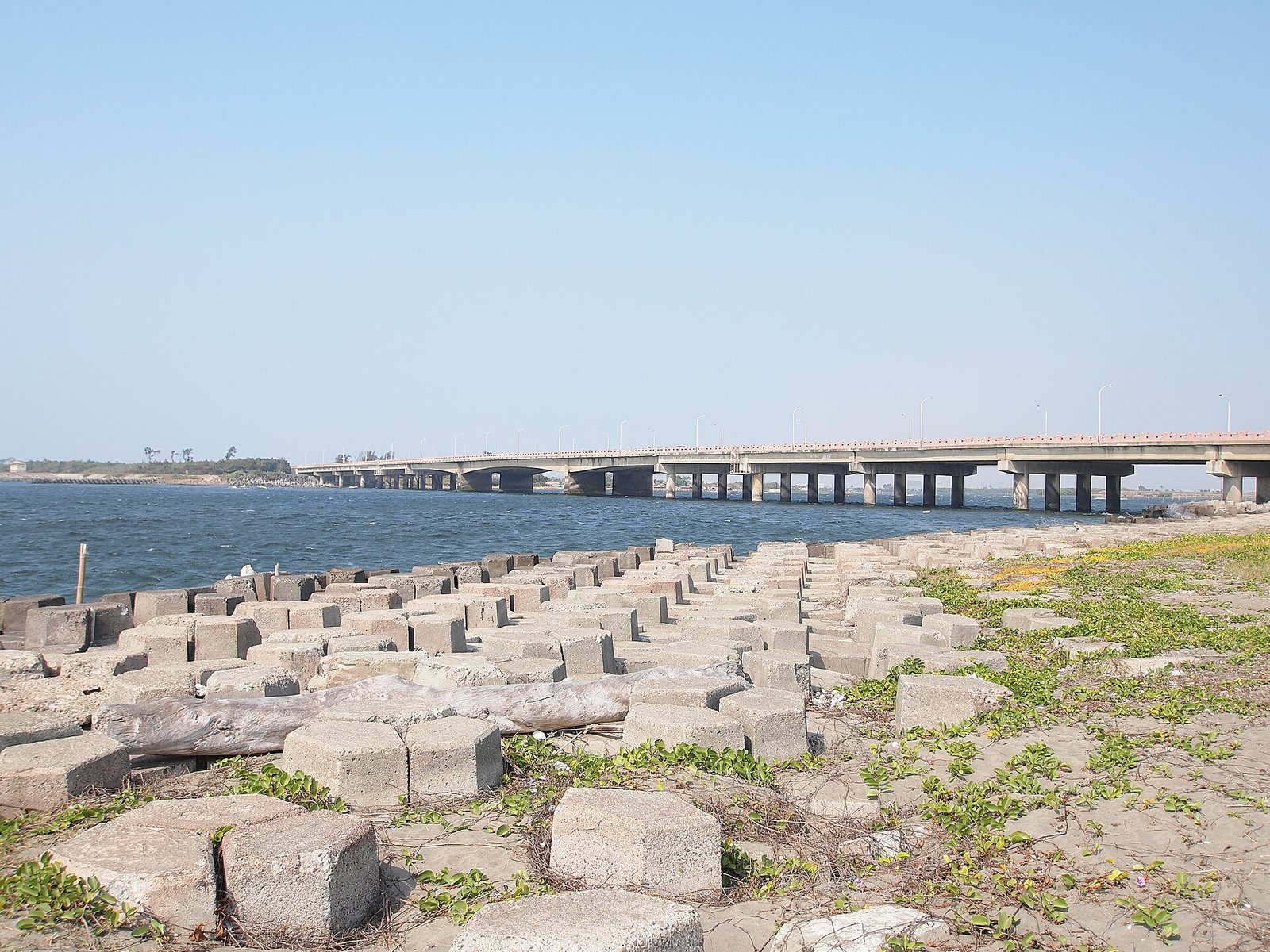
Sea-level rise in numbers
Official recordSea level around Taiwan is rising at twice the global average, about 3.4 millimeters per year over the past 20 years R001SourceCompilation of climate change data (sea level around Taiwan rising at twice the global average, about 3.4 mm per year over the past 20 years; rises of 0.5/1.2 m under 2℃/4℃ warming scenarios; under the 2℃ scenario, 3.29% of Tainan City's area flooded with a maximum depth of 1.5–2.0 m; another assessment finds the affected area largest in Tainan, at 426 km²)Original URLhttps://www.ncdr.nat.gov.tw/Retrieved2026-10-18Snapshot timestamp—The National Science and Technology Center for Disaster Reduction (國家災害防救科技中心) runs an online system, 「氣候變遷情境下海平面上升溢淹風險評估」 ["Assessment of Flooding Risk from Sea-Level Rise under Climate Change Scenarios"]; 《國家氣候變遷科學報告 2024》[National Climate Change Science Report 2024] has a dedicated chapter on coasts.. Under 2℃ and 4℃ warming scenarios, sea level around Taiwan would rise by 0.5 meters and 1.2 meters respectively R001SourceCompilation of climate change data (sea level around Taiwan rising at twice the global average, about 3.4 mm per year over the past 20 years; rises of 0.5/1.2 m under 2℃/4℃ warming scenarios; under the 2℃ scenario, 3.29% of Tainan City's area flooded with a maximum depth of 1.5–2.0 m; another assessment finds the affected area largest in Tainan, at 426 km²)Original URLhttps://www.ncdr.nat.gov.tw/Retrieved2026-10-18Snapshot timestamp—The National Science and Technology Center for Disaster Reduction (國家災害防救科技中心) runs an online system, 「氣候變遷情境下海平面上升溢淹風險評估」 ["Assessment of Flooding Risk from Sea-Level Rise under Climate Change Scenarios"]; 《國家氣候變遷科學報告 2024》[National Climate Change Science Report 2024] has a dedicated chapter on coasts..
Official recordUnder the 2℃ scenario, flooding in Tainan City (台南市) would be concentrated on the coastal sandbars, fish farm ponds, and lowlands, with 3.29 percent of the area inundated and a maximum depth of 1.5 to 2.0 meters; another assessment finds that Tainan has the largest affected area, at 426 square kilometers R001SourceCompilation of climate change data (sea level around Taiwan rising at twice the global average, about 3.4 mm per year over the past 20 years; rises of 0.5/1.2 m under 2℃/4℃ warming scenarios; under the 2℃ scenario, 3.29% of Tainan City's area flooded with a maximum depth of 1.5–2.0 m; another assessment finds the affected area largest in Tainan, at 426 km²)Original URLhttps://www.ncdr.nat.gov.tw/Retrieved2026-10-18Snapshot timestamp—The National Science and Technology Center for Disaster Reduction (國家災害防救科技中心) runs an online system, 「氣候變遷情境下海平面上升溢淹風險評估」 ["Assessment of Flooding Risk from Sea-Level Rise under Climate Change Scenarios"]; 《國家氣候變遷科學報告 2024》[National Climate Change Science Report 2024] has a dedicated chapter on coasts.. UnverifiedThese two figures come from different assessments with different baselines and scenario settings R001SourceCompilation of climate change data (sea level around Taiwan rising at twice the global average, about 3.4 mm per year over the past 20 years; rises of 0.5/1.2 m under 2℃/4℃ warming scenarios; under the 2℃ scenario, 3.29% of Tainan City's area flooded with a maximum depth of 1.5–2.0 m; another assessment finds the affected area largest in Tainan, at 426 km²)Original URLhttps://www.ncdr.nat.gov.tw/Retrieved2026-10-18Snapshot timestamp—The National Science and Technology Center for Disaster Reduction (國家災害防救科技中心) runs an online system, 「氣候變遷情境下海平面上升溢淹風險評估」 ["Assessment of Flooding Risk from Sea-Level Rise under Climate Change Scenarios"]; 《國家氣候變遷科學報告 2024》[National Climate Change Science Report 2024] has a dedicated chapter on coasts..
Protected-area provisions of the Coastal Zone Management Act
Official recordThe Coastal Zone Management Act (《海岸管理法》) provides that any place meeting one of the following conditions — important for the conservation of aquatic resources; an important habitat or ecological corridor for rare and precious flora and fauna; a special scenic resource or recreational area; an important coastal or underwater cultural heritage site; a special natural landform; or rich in biodiversity resources — must be designated a Class-1 coastal protected area R002SourceLegal framework (the 《海岸管理法》[Coastal Zone Management Act] provisions on when Class-1 coastal protected areas must be designated, and its definition of coastal hazards; the Ministry of the Interior's [內政部] 《整體海岸管理計畫》[Integrated Coastal Zone Management Plan], February 2017 [ROC year 106], and its 《第一次通盤檢討(草案)》[First Comprehensive Review (Draft)], January 2021 [ROC year 110])Original URLhttps://www.cpami.gov.tw/Retrieved2026-10-18Snapshot timestamp—. Coastal hazards, including coastal erosion, flood inundation, storm-surge flooding, and land subsidence, may lead to the designation of Class-1 or Class-2 coastal protection zones R002SourceLegal framework (the 《海岸管理法》[Coastal Zone Management Act] provisions on when Class-1 coastal protected areas must be designated, and its definition of coastal hazards; the Ministry of the Interior's [內政部] 《整體海岸管理計畫》[Integrated Coastal Zone Management Plan], February 2017 [ROC year 106], and its 《第一次通盤檢討(草案)》[First Comprehensive Review (Draft)], January 2021 [ROC year 110])Original URLhttps://www.cpami.gov.tw/Retrieved2026-10-18Snapshot timestamp—.
Official recordThe higher-level statutory plan is the Ministry of the Interior's (內政部) Integrated Coastal Zone Management Plan (《整體海岸管理計畫》, February 2017 [ROC year 106]) and its First Comprehensive Review (Draft) (《第一次通盤檢討(草案)》, January 2021 [ROC year 110]), which contains a dedicated chapter on coastal protection zones R002SourceLegal framework (the 《海岸管理法》[Coastal Zone Management Act] provisions on when Class-1 coastal protected areas must be designated, and its definition of coastal hazards; the Ministry of the Interior's [內政部] 《整體海岸管理計畫》[Integrated Coastal Zone Management Plan], February 2017 [ROC year 106], and its 《第一次通盤檢討(草案)》[First Comprehensive Review (Draft)], January 2021 [ROC year 110])Original URLhttps://www.cpami.gov.tw/Retrieved2026-10-18Snapshot timestamp—. The layer that applies to Tainan is the Tainan City Class-1 Coastal Protection Plan (《臺南市一級海岸防護計畫》) — both the Qingcaolun (青草崙) seawall and the Sicao (四草) seawall appear in its section-by-section list R007Source《臺南市一級海岸防護計畫(核定本)》[Tainan City Class-1 Coastal Protection Plan (Approved)] (coastal protection classes and erosion potential; approved by the Executive Yuan [行政院] on 2020-05-25 [ROC 109.5.25], 院臺建字第 1090087145 號; promulgated and implemented by the Ministry of Economic Affairs [經濟部] on 2020-06-15 [ROC 109.6.15], 經授水字第 10920209520 號)Original URLhttps://www.wra06.gov.tw/Retrieved2026-10-19Snapshot timestamp—.
The controversy over the Provincial Highway 61 bridge across the Zengwen River
First items: Nighttime impactsFollow-up survey projectMoreLess
Official recordThe original core of the controversy was migratory birds: even when elevated and not directly occupying the mudflats, Provincial Highway 61 would still cut the flight paths by which migratory birds move inland to rest, affecting their energy intake; examples of engineering countermeasures are ecological corridor bridges, noise barriers, and shielded streetlights R003SourceCore of the controversy over the Provincial Highway 61 West Coast Expressway (西濱快速公路) and migratory birds (even when elevated and not directly occupying the mudflats, it still cuts the flight paths by which migratory birds move inland to rest; examples of engineering countermeasures are ecological corridor bridges, noise barriers, and shielded streetlights)Original URLhttps://www.thb.gov.tw/Retrieved2026-10-18Snapshot timestamp—.
Official recordBut the 2020–2021 (ROC years 109–110) baseline survey added another layer: the piers of the bridge across the Zengwen River (曾文溪) land right on the Qingcaolun mudflat, near census site E — that is, where a stable population of the Formosan fiddler crab (臺灣旱招潮蟹) lives (the southernmost point of its range in Taiwan) R004Source《109-110 年度曾文溪口重要濕地(國際級)生態及水質基礎調查計畫》[2020–2021 Baseline Survey of Ecology and Water Quality of the Zengwen River Estuary Wetland of Importance (International Level)], NCKU Research and Development Foundation (成大研究發展基金會), co-principal investigator Liu Ching-yu (劉靜榆), July 2021 (ROC year 110) (the piers of the Provincial Highway 61 bridge across the Zengwen River land right on the Qingcaolun mudflat, near census site E; three statements by the Taijiang National Park Headquarters: the purpose of the project is to establish baseline data before construction begins, the pier sites should be on the mudflat with no construction access road, and construction may begin this year or next; Recommendation 3 requires that the effect of nighttime streetlights on wildlife be taken into account; printed pp. 78, 80, 83, 98, 101–102)Original URLhttps://www.tjnp.gov.tw/Retrieved2026-10-19Snapshot timestamp—. The Taijiang National Park Headquarters (台江處) itself left three statements in this report: the administrative purpose of the project is precisely 「在台 61 線跨曾文溪橋動工之前建立基礎資料」 ("to establish baseline data before construction of the Provincial Highway 61 bridge across the Zengwen River begins"); 「落墩位置應沒有在水域中,而是在灘地上,另落墩點不做施工便道及工區劃設」 ("the pier sites should not be in the water but on the mudflat, and no construction access road or work zone will be laid out at the pier sites"); and 「台 61 線跨曾文溪橋可能在今明年動工」 ("construction of the Provincial Highway 61 bridge across the Zengwen River may begin this year or next") (early 2021 [ROC year 110]) R004Source《109-110 年度曾文溪口重要濕地(國際級)生態及水質基礎調查計畫》[2020–2021 Baseline Survey of Ecology and Water Quality of the Zengwen River Estuary Wetland of Importance (International Level)], NCKU Research and Development Foundation (成大研究發展基金會), co-principal investigator Liu Ching-yu (劉靜榆), July 2021 (ROC year 110) (the piers of the Provincial Highway 61 bridge across the Zengwen River land right on the Qingcaolun mudflat, near census site E; three statements by the Taijiang National Park Headquarters: the purpose of the project is to establish baseline data before construction begins, the pier sites should be on the mudflat with no construction access road, and construction may begin this year or next; Recommendation 3 requires that the effect of nighttime streetlights on wildlife be taken into account; printed pp. 78, 80, 83, 98, 101–102)Original URLhttps://www.tjnp.gov.tw/Retrieved2026-10-19Snapshot timestamp—.
Official recordThe report's management recommendation for the Formosan fiddler crab is: 「台 61 線跨曾文溪橋工程需多加留意棲地環境的變化,加強與施工單位的溝通」 ("the Provincial Highway 61 bridge works across the Zengwen River require closer attention to changes in the habitat environment and stronger communication with the construction contractor") R004Source《109-110 年度曾文溪口重要濕地(國際級)生態及水質基礎調查計畫》[2020–2021 Baseline Survey of Ecology and Water Quality of the Zengwen River Estuary Wetland of Importance (International Level)], NCKU Research and Development Foundation (成大研究發展基金會), co-principal investigator Liu Ching-yu (劉靜榆), July 2021 (ROC year 110) (the piers of the Provincial Highway 61 bridge across the Zengwen River land right on the Qingcaolun mudflat, near census site E; three statements by the Taijiang National Park Headquarters: the purpose of the project is to establish baseline data before construction begins, the pier sites should be on the mudflat with no construction access road, and construction may begin this year or next; Recommendation 3 requires that the effect of nighttime streetlights on wildlife be taken into account; printed pp. 78, 80, 83, 98, 101–102)Original URLhttps://www.tjnp.gov.tw/Retrieved2026-10-19Snapshot timestamp—.
Official recordUnder the national park zoning, site E lies about 747 meters outside the national park zoning boundary (water-quality station St.4 lies 628 meters outside) R005SourceDetermination from the Taijiang National Park zoning vector data (the 「國家公園土地使用分區」[National Park Land Use Zoning] layer of the National Spatial Planning GIS Platform of the 內政部國土管理署 [National Land Management Agency, Ministry of the Interior]; site E = the Provincial Highway 61 pier site, 747 m outside the zoning boundary; water-quality station St.4, 628 m outside)Original URLhttps://nspi.nlma.gov.tw/Retrieved2026-10-20Snapshot timestamp—. UnverifiedIn other words, the works are outside the boundary and the impacts inside it R005SourceDetermination from the Taijiang National Park zoning vector data (the 「國家公園土地使用分區」[National Park Land Use Zoning] layer of the National Spatial Planning GIS Platform of the 內政部國土管理署 [National Land Management Agency, Ministry of the Interior]; site E = the Provincial Highway 61 pier site, 747 m outside the zoning boundary; water-quality station St.4, 628 m outside)Original URLhttps://nspi.nlma.gov.tw/Retrieved2026-10-20Snapshot timestamp—. For the detailed alignment of sampling sites and zones, see 5.3b The Two Faces of the Qingcaolun Seawall.
Nighttime impacts
Official recordRecommendation 3 of the same report (with the highway authority as the responsible agency) already expressly requires that 「車輛往來的噪音、夜間路燈燈光對生物的影響以及人流所產生的垃圾,都需要列入考量」 ("the noise of passing vehicles, the effect of nighttime streetlights on wildlife, and the litter generated by visitors must all be taken into account") R004Source《109-110 年度曾文溪口重要濕地(國際級)生態及水質基礎調查計畫》[2020–2021 Baseline Survey of Ecology and Water Quality of the Zengwen River Estuary Wetland of Importance (International Level)], NCKU Research and Development Foundation (成大研究發展基金會), co-principal investigator Liu Ching-yu (劉靜榆), July 2021 (ROC year 110) (the piers of the Provincial Highway 61 bridge across the Zengwen River land right on the Qingcaolun mudflat, near census site E; three statements by the Taijiang National Park Headquarters: the purpose of the project is to establish baseline data before construction begins, the pier sites should be on the mudflat with no construction access road, and construction may begin this year or next; Recommendation 3 requires that the effect of nighttime streetlights on wildlife be taken into account; printed pp. 78, 80, 83, 98, 101–102)Original URLhttps://www.tjnp.gov.tw/Retrieved2026-10-19Snapshot timestamp—.
Follow-up survey project
Official recordIn Recommendation 6 the authorities wrote down the full title of the follow-up project: 2022–2023 Survey of the Ecology and Biodiversity of the South-Bank Qingcaolun Mudflat (Construction Impacts) (《111-112 年 南岸青草崙灘地生態及生物多樣性物種調查(工程衝擊影響)》), with the Taijiang National Park Headquarters (台江國家公園管理處) and the Agriculture Bureau, Tainan City Government (臺南市政府農業局) as the responsible agencies R006SourceOfficial title of the follow-up project: 《111-112 年 南岸青草崙灘地生態及生物多樣性物種調查(工程衝擊影響)》[2022–2023 Survey of the Ecology and Biodiversity of the South-Bank Qingcaolun Mudflat (Construction Impacts)], commissioning agencies the Taijiang National Park Headquarters (台江國家公園管理處) and the Agriculture Bureau, Tainan City Government (臺南市政府農業局) (Recommendation 6, printed p. 84)Original URLhttps://www.tjnp.gov.tw/Retrieved2026-10-19Snapshot timestamp—Commissioned research reports; the latest year available is 2020–2021 (ROC years 109–110)..
Chronology: the legal framework for wetlands and protected areas
First items: The Council of Agriculture (農委會), under …The Tainan City Government announced the…The Tainan County Government announced t…MoreLess
- 1992
July 1992The Council of Agriculture (農委會), under …MoreLess
The Council of Agriculture (農委會), under the Wildlife Conservation Act (野生動物保育法), announced the black-faced spoonbill (黑面琵鷺) as an endangered protected species R018Source國家公園署 [National Park Service] 濕地保育資訊網 [Wetland Conservation Information Network], detail page for the 「曾文溪口重要濕地」 [Zengwen River Estuary Wetland of Importance] (the website is offline; Internet Archive snapshot)Original URL—Retrieved2026-11-01Snapshot timestamp—「1992年7月,農委會依野生動物保育法公告黑面琵鷺為瀕臨絕種保育類野生動物」 ("In July 1992 the Council of Agriculture, under the Wildlife Conservation Act, announced the black-faced spoonbill as an endangered protected species"); wetland area 3,001 ha..
- 1994
11-30The Tainan City Government announced the…MoreLess
The Tainan City Government announced the Sicao Wildlife Reserve (四草野生動物保護區), 515.1 hectares R015Source臺南市政府 [Tainan City Government] announcement 八三南市建農字第一三二六二九號 [(83) Nan-Shi-Jian-Nong No. 132629] of 1994-11-30, designating the Sicao Wildlife Reserve (四草野生動物保護區) (515.1 ha)Original URLhttps://www.forest.gov.tw/file/202325Retrieved2026-11-01Snapshot timestamp—.
- 2002
11-01The Tainan County Government announced t…MoreLess
The Tainan County Government announced the Black-faced Spoonbill Reserve on the North Bank of the Zengwen River Mouth (曾文溪口北岸黑面琵鷺保護區), 300 hectares R016Source臺南縣政府 [Tainan County Government] announcement 府農林字第0910179659號 [Fu-Nong-Lin No. 0910179659] of 2002-11-01, designating the Black-faced Spoonbill Reserve on the North Bank of the Zengwen River Mouth (曾文溪口北岸黑面琵鷺保護區) (300 ha)Original URLhttps://www.forest.gov.tw/file/199219Retrieved2026-11-01Snapshot timestamp—.
- 2007
12-20The Ministry of the Interior announced 7…MoreLess
The Ministry of the Interior announced 75 wetlands of national importance R010Source監察院 [Control Yuan] briefing on its investigation report (investigating members Lin Yu-jung (林郁容), Fan Sun-lu (范巽綠), and Yeh Yi-jin (葉宜津)), 2024-12-05: conservation and wise-use plans for wetlands of national importance overdue for reviewOriginal URLhttps://cybsbox.cy.gov.tw/CYBSBoxSSL/edoc/download/68328Retrieved2026-11-01Snapshot timestamp—On 2007-12-20, 75 wetlands of national importance were announced; on 2015-01-28 the confirmed boundaries of 42 were announced; 8 are overdue for review (Zengwen River estuary and Qigu Salt Field: public exhibition 2016-02-01 to 2016-03-01 [ROC 105.2.1–105.3.1], 180-day deadline 2016-08-28 [ROC 105.8.28]); Article 40 of the Wetland Conservation Act; 86 black-faced spoonbills rescued in 2023–2024 (73 in Tainan)..
- 2011
01-18Wetlands of national importance increase…MoreLess
Wetlands of national importance increased to 82 R014Source中華民國野鳥學會 [Chinese Wild Bird Federation], 《Important Bird Areas in Taiwan》, 2nd edition, 2015Original URLhttps://www.bird.org.tw/sites/default/files/field/file/download/IBAs%20in%20Taiwan%20%20%28second%20edition%29.pdfRetrieved2026-11-01Snapshot timestamp—SourceFrom 《Important Bird Areas in Taiwan (臺灣重要野鳥棲地), Second Edition》p. 14–15、204–205Pp. 14–15, chronology (82 wetlands of national importance announced on 2011-01-18); pp. 204–205, summary table in Appendix 1 (TW027 Qigu, 9,424 ha; TW029 Sicao, 4,038 ha)..
- 2013
07-03The President promulgated the Wetland Co…MoreLess
The President promulgated the Wetland Conservation Act (《濕地保育法》) R008Source行政院公報 [Executive Yuan Gazette] vol. 019, no. 125: presidential order 華總一義字第10200127201號 [Hua-Zong-Yi-Yi No. 10200127201] of 2013-07-03 (ROC 102) promulgating the 《濕地保育法》 [Wetland Conservation Act]Original URLhttps://gazette.nat.gov.tw/Retrieved2026-11-01Snapshot timestamp—.
- 2015
01-28The Ministry of the Interior announced t…MoreLess
The Ministry of the Interior announced the confirmed boundaries of 42 wetlands of national importance of international and national level R010Source監察院 [Control Yuan] briefing on its investigation report (investigating members Lin Yu-jung (林郁容), Fan Sun-lu (范巽綠), and Yeh Yi-jin (葉宜津)), 2024-12-05: conservation and wise-use plans for wetlands of national importance overdue for reviewOriginal URLhttps://cybsbox.cy.gov.tw/CYBSBoxSSL/edoc/download/68328Retrieved2026-11-01Snapshot timestamp—On 2007-12-20, 75 wetlands of national importance were announced; on 2015-01-28 the confirmed boundaries of 42 were announced; 8 are overdue for review (Zengwen River estuary and Qigu Salt Field: public exhibition 2016-02-01 to 2016-03-01 [ROC 105.2.1–105.3.1], 180-day deadline 2016-08-28 [ROC 105.8.28]); Article 40 of the Wetland Conservation Act; 86 black-faced spoonbills rescued in 2023–2024 (73 in Tainan)..- 02-02The Wetland Conservation Act took effect R009Source行政院公報 [Executive Yuan Gazette] vol. 020, no. 109: Executive Yuan order 院臺建字第1030030131號 [Yuan-Tai-Jian No. 1030030131] of 2014-06-12 (ROC 103), setting the 《濕地保育法》 [Wetland Conservation Act] to take effect on February 2, 2015 (ROC year 104)Original URLhttps://gazette.nat.gov.tw/Retrieved2026-11-01Snapshot timestamp—.
- 2016
02-01~03-01Public exhibition of the conservation an…MoreLess
Public exhibition of the conservation and wise-use plans for the Zengwen River estuary, Qigu Salt Field, and Yanshui River estuary wetlands of importance R010Source監察院 [Control Yuan] briefing on its investigation report (investigating members Lin Yu-jung (林郁容), Fan Sun-lu (范巽綠), and Yeh Yi-jin (葉宜津)), 2024-12-05: conservation and wise-use plans for wetlands of national importance overdue for reviewOriginal URLhttps://cybsbox.cy.gov.tw/CYBSBoxSSL/edoc/download/68328Retrieved2026-11-01Snapshot timestamp—On 2007-12-20, 75 wetlands of national importance were announced; on 2015-01-28 the confirmed boundaries of 42 were announced; 8 are overdue for review (Zengwen River estuary and Qigu Salt Field: public exhibition 2016-02-01 to 2016-03-01 [ROC 105.2.1–105.3.1], 180-day deadline 2016-08-28 [ROC 105.8.28]); Article 40 of the Wetland Conservation Act; 86 black-faced spoonbills rescued in 2023–2024 (73 in Tainan)..05-05The Ministry of the Interior delegated t…MoreLess
The Ministry of the Interior delegated the affairs of four wetlands of importance to the Taijiang National Park Headquarters R013Source行政院公報 [Executive Yuan Gazette] vol. 022, no. 084 (台內營字第1050805939號 [Tai-Nei-Ying No. 1050805939] of 2016-05-05 [ROC 105]) and vol. 029, no. 098 (台內營字第1120806392號 [Tai-Nei-Ying No. 1120806392] of 2023-05-29 [ROC 112]): the Ministry of the Interior delegates wetland-of-importance affairs to the Taijiang National Park Headquarters (台江國家公園管理處)Original URLhttps://gazette.nat.gov.tw/Retrieved2026-11-01Snapshot timestamp—.08-28The statutory review deadline for the co…MoreLess
The statutory review deadline for the conservation and wise-use plans for the Zengwen River estuary and the Qigu Salt Field expired R010Source監察院 [Control Yuan] briefing on its investigation report (investigating members Lin Yu-jung (林郁容), Fan Sun-lu (范巽綠), and Yeh Yi-jin (葉宜津)), 2024-12-05: conservation and wise-use plans for wetlands of national importance overdue for reviewOriginal URLhttps://cybsbox.cy.gov.tw/CYBSBoxSSL/edoc/download/68328Retrieved2026-11-01Snapshot timestamp—On 2007-12-20, 75 wetlands of national importance were announced; on 2015-01-28 the confirmed boundaries of 42 were announced; 8 are overdue for review (Zengwen River estuary and Qigu Salt Field: public exhibition 2016-02-01 to 2016-03-01 [ROC 105.2.1–105.3.1], 180-day deadline 2016-08-28 [ROC 105.8.28]); Article 40 of the Wetland Conservation Act; 86 black-faced spoonbills rescued in 2023–2024 (73 in Tainan)..
- 2017
05-10The conservation and wise-use plan for t…MoreLess
The conservation and wise-use plan for the Yanshui River Estuary Wetland of Importance (鹽水溪口重要濕地) was announced R011Source行政院公報 [Executive Yuan Gazette] vol. 023, no. 087: Ministry of the Interior announcement 台內營字第1060805480號 [Tai-Nei-Ying No. 1060805480] of 2017-05-10 (ROC 106), of the 「鹽水溪口重要濕地(國家級)保育利用計畫」 [Conservation and Wise-Use Plan for the Yanshui River Estuary Wetland of Importance (National Level)]Original URLhttps://gazette.nat.gov.tw/Retrieved2026-11-01Snapshot timestamp—.
- 2018
03-16The conservation and wise-use plan for t…MoreLess
The conservation and wise-use plan for the Sicao Wetland of Importance (四草重要濕地) was announced R012Source行政院公報 [Executive Yuan Gazette] vol. 024, no. 051: Ministry of the Interior announcement 台內營字第1070803676號 [Tai-Nei-Ying No. 1070803676] of 2018-03-16 (ROC 107), of the 「四草重要濕地(國際級)保育利用計畫」 [Conservation and Wise-Use Plan for the Sicao Wetland of Importance (International Level)]Original URLhttps://gazette.nat.gov.tw/Retrieved2026-11-01Snapshot timestamp—.
- 2020
05-25The Executive Yuan approved the Tainan C…MoreLess
The Executive Yuan approved the Tainan City Class-1 Coastal Protection Plan (《臺南市一級海岸防護計畫》) R007Source《臺南市一級海岸防護計畫(核定本)》[Tainan City Class-1 Coastal Protection Plan (Approved)] (coastal protection classes and erosion potential; approved by the Executive Yuan [行政院] on 2020-05-25 [ROC 109.5.25], 院臺建字第 1090087145 號; promulgated and implemented by the Ministry of Economic Affairs [經濟部] on 2020-06-15 [ROC 109.6.15], 經授水字第 10920209520 號)Original URLhttps://www.wra06.gov.tw/Retrieved2026-10-19Snapshot timestamp—.
- 2023
05-29The Ministry of the Interior renewed the…MoreLess
The Ministry of the Interior renewed the delegation to the Taijiang National Park Headquarters R013Source行政院公報 [Executive Yuan Gazette] vol. 022, no. 084 (台內營字第1050805939號 [Tai-Nei-Ying No. 1050805939] of 2016-05-05 [ROC 105]) and vol. 029, no. 098 (台內營字第1120806392號 [Tai-Nei-Ying No. 1120806392] of 2023-05-29 [ROC 112]): the Ministry of the Interior delegates wetland-of-importance affairs to the Taijiang National Park Headquarters (台江國家公園管理處)Original URLhttps://gazette.nat.gov.tw/Retrieved2026-11-01Snapshot timestamp—.
- 2024
12-05A Control Yuan (監察院) investigation found…MoreLess
A Control Yuan (監察院) investigation found that the conservation and wise-use plans for 1 international-level and 7 national-level wetlands of importance were overdue for review, the Zengwen River estuary and the Qigu Salt Field among them R010Source監察院 [Control Yuan] briefing on its investigation report (investigating members Lin Yu-jung (林郁容), Fan Sun-lu (范巽綠), and Yeh Yi-jin (葉宜津)), 2024-12-05: conservation and wise-use plans for wetlands of national importance overdue for reviewOriginal URLhttps://cybsbox.cy.gov.tw/CYBSBoxSSL/edoc/download/68328Retrieved2026-11-01Snapshot timestamp—On 2007-12-20, 75 wetlands of national importance were announced; on 2015-01-28 the confirmed boundaries of 42 were announced; 8 are overdue for review (Zengwen River estuary and Qigu Salt Field: public exhibition 2016-02-01 to 2016-03-01 [ROC 105.2.1–105.3.1], 180-day deadline 2016-08-28 [ROC 105.8.28]); Article 40 of the Wetland Conservation Act; 86 black-faced spoonbills rescued in 2023–2024 (73 in Tainan)..
- 2025
10-17The conservation plans for the two refug…MoreLess
The conservation plans for the two refuges, Sicao and the north bank of the Zengwen River mouth, were approved by the Ministry of Agriculture R017Source農業部林業及自然保育署 [Forestry and Nature Conservation Agency, Ministry of Agriculture], 〈臺南市四草野生動物保護區〉 [Sicao Wildlife Reserve, Tainan City], basic information and attachments (conservation plan approved by Ministry of Agriculture letter 農業部農林業字第1140242662號 [Nong-Lin-Ye No. 1140242662] of 2025-10-17; amendment of the regulated activities announced under 府農森字第1150194587A號 [Fu-Nong-Sen No. 1150194587A] of 2026-02-02)Original URLhttps://www.forest.gov.tw/0007981Retrieved2026-11-01Snapshot timestamp—Announcement of the amendment of the regulated activities: https://www.forest.gov.tw/file/199177 ..
- 2026
02-02An amendment of the regulated activities…MoreLess
An amendment of the regulated activities for the two refuges was announced, adding 「全區禁止餵食野生動物及遊蕩動物」 ("feeding of wildlife and roaming animals prohibited throughout the area") R017Source農業部林業及自然保育署 [Forestry and Nature Conservation Agency, Ministry of Agriculture], 〈臺南市四草野生動物保護區〉 [Sicao Wildlife Reserve, Tainan City], basic information and attachments (conservation plan approved by Ministry of Agriculture letter 農業部農林業字第1140242662號 [Nong-Lin-Ye No. 1140242662] of 2025-10-17; amendment of the regulated activities announced under 府農森字第1150194587A號 [Fu-Nong-Sen No. 1150194587A] of 2026-02-02)Original URLhttps://www.forest.gov.tw/0007981Retrieved2026-11-01Snapshot timestamp—Announcement of the amendment of the regulated activities: https://www.forest.gov.tw/file/199177 ..
Statutory conservation areas in this area and their extent
MoreLess
The same land is often covered by several layers of law at once, and the areas of the different layers must not be added together.
| Name | Legal basis | Area (hectares) | Source |
|---|---|---|---|
| Zengwen River Estuary Wetland of Importance (International Level) (曾文溪口重要濕地(國際級)) | Wetland Conservation Act | 3,001 (conservation and wise-use plan not approved) | R018Source國家公園署 [National Park Service] 濕地保育資訊網 [Wetland Conservation Information Network], detail page for the 「曾文溪口重要濕地」 [Zengwen River Estuary Wetland of Importance] (the website is offline; Internet Archive snapshot)Original URL—Retrieved2026-11-01Snapshot timestamp—「1992年7月,農委會依野生動物保育法公告黑面琵鷺為瀕臨絕種保育類野生動物」 ("In July 1992 the Council of Agriculture, under the Wildlife Conservation Act, announced the black-faced spoonbill as an endangered protected species"); wetland area 3,001 ha.R010Source監察院 [Control Yuan] briefing on its investigation report (investigating members Lin Yu-jung (林郁容), Fan Sun-lu (范巽綠), and Yeh Yi-jin (葉宜津)), 2024-12-05: conservation and wise-use plans for wetlands of national importance overdue for reviewOriginal URLhttps://cybsbox.cy.gov.tw/CYBSBoxSSL/edoc/download/68328Retrieved2026-11-01Snapshot timestamp—On 2007-12-20, 75 wetlands of national importance were announced; on 2015-01-28 the confirmed boundaries of 42 were announced; 8 are overdue for review (Zengwen River estuary and Qigu Salt Field: public exhibition 2016-02-01 to 2016-03-01 [ROC 105.2.1–105.3.1], 180-day deadline 2016-08-28 [ROC 105.8.28]); Article 40 of the Wetland Conservation Act; 86 black-faced spoonbills rescued in 2023–2024 (73 in Tainan). |
| Sicao Wetland of Importance (International Level) (四草重要濕地(國際級)) | Wetland Conservation Act | 550.56 per the plan | R012Source行政院公報 [Executive Yuan Gazette] vol. 024, no. 051: Ministry of the Interior announcement 台內營字第1070803676號 [Tai-Nei-Ying No. 1070803676] of 2018-03-16 (ROC 107), of the 「四草重要濕地(國際級)保育利用計畫」 [Conservation and Wise-Use Plan for the Sicao Wetland of Importance (International Level)]Original URLhttps://gazette.nat.gov.tw/Retrieved2026-11-01Snapshot timestamp— |
| Yanshui River Estuary Wetland of Importance (National Level) (鹽水溪口重要濕地(國家級)) | Wetland Conservation Act | 452.77 per the plan | R011Source行政院公報 [Executive Yuan Gazette] vol. 023, no. 087: Ministry of the Interior announcement 台內營字第1060805480號 [Tai-Nei-Ying No. 1060805480] of 2017-05-10 (ROC 106), of the 「鹽水溪口重要濕地(國家級)保育利用計畫」 [Conservation and Wise-Use Plan for the Yanshui River Estuary Wetland of Importance (National Level)]Original URLhttps://gazette.nat.gov.tw/Retrieved2026-11-01Snapshot timestamp— |
| Sicao Wildlife Reserve (current) (四草野生動物保護區(現行)) | Wildlife Conservation Act | 543.1860 | R017Source農業部林業及自然保育署 [Forestry and Nature Conservation Agency, Ministry of Agriculture], 〈臺南市四草野生動物保護區〉 [Sicao Wildlife Reserve, Tainan City], basic information and attachments (conservation plan approved by Ministry of Agriculture letter 農業部農林業字第1140242662號 [Nong-Lin-Ye No. 1140242662] of 2025-10-17; amendment of the regulated activities announced under 府農森字第1150194587A號 [Fu-Nong-Sen No. 1150194587A] of 2026-02-02)Original URLhttps://www.forest.gov.tw/0007981Retrieved2026-11-01Snapshot timestamp—Announcement of the amendment of the regulated activities: https://www.forest.gov.tw/file/199177 . |
| Black-faced Spoonbill Reserve on the North Bank of the Zengwen River Mouth (曾文溪口北岸黑面琵鷺保護區) | Wildlife Conservation Act | 300 | R016Source臺南縣政府 [Tainan County Government] announcement 府農林字第0910179659號 [Fu-Nong-Lin No. 0910179659] of 2002-11-01, designating the Black-faced Spoonbill Reserve on the North Bank of the Zengwen River Mouth (曾文溪口北岸黑面琵鷺保護區) (300 ha)Original URLhttps://www.forest.gov.tw/file/199219Retrieved2026-11-01Snapshot timestamp— |
| Ecological Protection Area 1: Beishanwei Waterbird Ecological Reserve (生一 北汕尾水鳥生態保護區) | National Park Act | 278.97 | R019Source《臺江國家公園計畫(第 1 次通盤檢討)核定本》 [Taijiang National Park Plan (First Comprehensive Review), Approved Edition], Table 8-2, area of each zone (approved by the Executive Yuan under 院臺建字第 1070017849 號 on 2018-06-05 [ROC 107.6.5]; announced by the Ministry of the Interior under 台內營字第 1070813932 號 on 2018-08-22 [ROC 107.8.22])Original URLhttps://gazette.nat.gov.tw/Retrieved2026-11-01Snapshot timestamp— |
| Ecological Protection Area 2: Luermen Shorebird Ecological Reserve (生二 鹿耳門鷸鴴科生態保護區) | National Park Act | 43.89 | R019Source《臺江國家公園計畫(第 1 次通盤檢討)核定本》 [Taijiang National Park Plan (First Comprehensive Review), Approved Edition], Table 8-2, area of each zone (approved by the Executive Yuan under 院臺建字第 1070017849 號 on 2018-06-05 [ROC 107.6.5]; announced by the Ministry of the Interior under 台內營字第 1070813932 號 on 2018-08-22 [ROC 107.8.22])Original URLhttps://gazette.nat.gov.tw/Retrieved2026-11-01Snapshot timestamp— |
| Ecological Protection Area 3: Shifen Black-faced Spoonbill Ecological Reserve (生三 十份黑面琵鷺生態保護區) | National Park Act | 296.47 | R019Source《臺江國家公園計畫(第 1 次通盤檢討)核定本》 [Taijiang National Park Plan (First Comprehensive Review), Approved Edition], Table 8-2, area of each zone (approved by the Executive Yuan under 院臺建字第 1070017849 號 on 2018-06-05 [ROC 107.6.5]; announced by the Ministry of the Interior under 台內營字第 1070813932 號 on 2018-08-22 [ROC 107.8.22])Original URLhttps://gazette.nat.gov.tw/Retrieved2026-11-01Snapshot timestamp— |
| Ecological Protection Area 4: Qigu River Estuary Mangrove Ecological Protection Area (生四 七股溪口紅樹林生態保護區) | National Park Act | 5.64 | R019Source《臺江國家公園計畫(第 1 次通盤檢討)核定本》 [Taijiang National Park Plan (First Comprehensive Review), Approved Edition], Table 8-2, area of each zone (approved by the Executive Yuan under 院臺建字第 1070017849 號 on 2018-06-05 [ROC 107.6.5]; announced by the Ministry of the Interior under 台內營字第 1070813932 號 on 2018-08-22 [ROC 107.8.22])Original URLhttps://gazette.nat.gov.tw/Retrieved2026-11-01Snapshot timestamp— |
| Special Landscape Area 3: Chengxi Wetland Special Landscape Area (特三 城西濕地特別景觀區) | National Park Act | 106.19 | R019Source《臺江國家公園計畫(第 1 次通盤檢討)核定本》 [Taijiang National Park Plan (First Comprehensive Review), Approved Edition], Table 8-2, area of each zone (approved by the Executive Yuan under 院臺建字第 1070017849 號 on 2018-06-05 [ROC 107.6.5]; announced by the Ministry of the Interior under 台內營字第 1070813932 號 on 2018-08-22 [ROC 107.8.22])Original URLhttps://gazette.nat.gov.tw/Retrieved2026-11-01Snapshot timestamp— |
| Qigu Important Bird Area (IBA TW027) (七股重要野鳥棲地) | BirdLife International criteria | 9,424 | R014Source中華民國野鳥學會 [Chinese Wild Bird Federation], 《Important Bird Areas in Taiwan》, 2nd edition, 2015Original URLhttps://www.bird.org.tw/sites/default/files/field/file/download/IBAs%20in%20Taiwan%20%20%28second%20edition%29.pdfRetrieved2026-11-01Snapshot timestamp—SourceFrom 《Important Bird Areas in Taiwan (臺灣重要野鳥棲地), Second Edition》p. 14–15、204–205Pp. 14–15, chronology (82 wetlands of national importance announced on 2011-01-18); pp. 204–205, summary table in Appendix 1 (TW027 Qigu, 9,424 ha; TW029 Sicao, 4,038 ha). |
| Sicao Important Bird Area (IBA TW029) (四草重要野鳥棲地) | BirdLife International criteria | 4,038 | R014Source中華民國野鳥學會 [Chinese Wild Bird Federation], 《Important Bird Areas in Taiwan》, 2nd edition, 2015Original URLhttps://www.bird.org.tw/sites/default/files/field/file/download/IBAs%20in%20Taiwan%20%20%28second%20edition%29.pdfRetrieved2026-11-01Snapshot timestamp—SourceFrom 《Important Bird Areas in Taiwan (臺灣重要野鳥棲地), Second Edition》p. 14–15、204–205Pp. 14–15, chronology (82 wetlands of national importance announced on 2011-01-18); pp. 204–205, summary table in Appendix 1 (TW027 Qigu, 9,424 ha; TW029 Sicao, 4,038 ha). |
Official recordAs of November 2026, the conservation and wise-use plans for the two wetlands of importance at the Zengwen River estuary and the Qigu Salt Field have still not been announced; nor has a "first review" been announced for Sicao or the Yanshui River estuary R010Source監察院 [Control Yuan] briefing on its investigation report (investigating members Lin Yu-jung (林郁容), Fan Sun-lu (范巽綠), and Yeh Yi-jin (葉宜津)), 2024-12-05: conservation and wise-use plans for wetlands of national importance overdue for reviewOriginal URLhttps://cybsbox.cy.gov.tw/CYBSBoxSSL/edoc/download/68328Retrieved2026-11-01Snapshot timestamp—On 2007-12-20, 75 wetlands of national importance were announced; on 2015-01-28 the confirmed boundaries of 42 were announced; 8 are overdue for review (Zengwen River estuary and Qigu Salt Field: public exhibition 2016-02-01 to 2016-03-01 [ROC 105.2.1–105.3.1], 180-day deadline 2016-08-28 [ROC 105.8.28]); Article 40 of the Wetland Conservation Act; 86 black-faced spoonbills rescued in 2023–2024 (73 in Tainan).R011Source行政院公報 [Executive Yuan Gazette] vol. 023, no. 087: Ministry of the Interior announcement 台內營字第1060805480號 [Tai-Nei-Ying No. 1060805480] of 2017-05-10 (ROC 106), of the 「鹽水溪口重要濕地(國家級)保育利用計畫」 [Conservation and Wise-Use Plan for the Yanshui River Estuary Wetland of Importance (National Level)]Original URLhttps://gazette.nat.gov.tw/Retrieved2026-11-01Snapshot timestamp—R012Source行政院公報 [Executive Yuan Gazette] vol. 024, no. 051: Ministry of the Interior announcement 台內營字第1070803676號 [Tai-Nei-Ying No. 1070803676] of 2018-03-16 (ROC 107), of the 「四草重要濕地(國際級)保育利用計畫」 [Conservation and Wise-Use Plan for the Sicao Wetland of Importance (International Level)]Original URLhttps://gazette.nat.gov.tw/Retrieved2026-11-01Snapshot timestamp—. For details on the Zengwen River estuary, see 5.2 Qigu; for Sicao, see 5.4 Sicao and the Mouth of the Yanshui River.
Differing accounts
- UnverifiedThe location corresponding to the pier site of the bridge across the Zengwen River; the two candidates are about 440 meters apart:
- Table 4 and the discussion chapter: sampling site E R004Source《109-110 年度曾文溪口重要濕地(國際級)生態及水質基礎調查計畫》[2020–2021 Baseline Survey of Ecology and Water Quality of the Zengwen River Estuary Wetland of Importance (International Level)], NCKU Research and Development Foundation (成大研究發展基金會), co-principal investigator Liu Ching-yu (劉靜榆), July 2021 (ROC year 110) (the piers of the Provincial Highway 61 bridge across the Zengwen River land right on the Qingcaolun mudflat, near census site E; three statements by the Taijiang National Park Headquarters: the purpose of the project is to establish baseline data before construction begins, the pier sites should be on the mudflat with no construction access road, and construction may begin this year or next; Recommendation 3 requires that the effect of nighttime streetlights on wildlife be taken into account; printed pp. 78, 80, 83, 98, 101–102)Original URLhttps://www.tjnp.gov.tw/Retrieved2026-10-19Snapshot timestamp—.
- The reply to the mid-term review: water-quality station St.4 R004Source《109-110 年度曾文溪口重要濕地(國際級)生態及水質基礎調查計畫》[2020–2021 Baseline Survey of Ecology and Water Quality of the Zengwen River Estuary Wetland of Importance (International Level)], NCKU Research and Development Foundation (成大研究發展基金會), co-principal investigator Liu Ching-yu (劉靜榆), July 2021 (ROC year 110) (the piers of the Provincial Highway 61 bridge across the Zengwen River land right on the Qingcaolun mudflat, near census site E; three statements by the Taijiang National Park Headquarters: the purpose of the project is to establish baseline data before construction begins, the pier sites should be on the mudflat with no construction access road, and construction may begin this year or next; Recommendation 3 requires that the effect of nighttime streetlights on wildlife be taken into account; printed pp. 78, 80, 83, 98, 101–102)Original URLhttps://www.tjnp.gov.tw/Retrieved2026-10-19Snapshot timestamp—.
Behind this door is the internal site, with profiles of people and local comments. The internal site is deployed separately.