What it is
This stretch of coast is the downdrift end of "erosion in the south, accretion in the north" (「南侵北淤」): Kunshen (鯤鯓), north of the Anping Commercial Port (安平商港) breakwater, grows by more than ten meters a year, while Xishu (喜樹) and Wanli (灣裡) to the south retreat by several meters a year — and this is where the journey of a grain of sand is cut short.
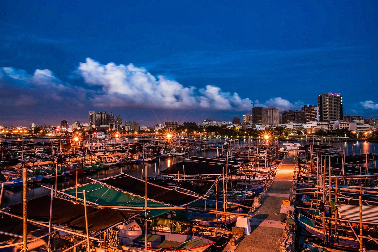
Two faces: accretion and retreat
MoreLess
Official recordOfficial section-by-section monitoring measures both faces of this stretch clearly. Between the Anping Commercial Port and the Erren River (二仁溪), the Kunshen Seawall section (S221–S232) is accreting at +5.31 to +13.32 meters per year, with a current beach width of 377.86 meters; the Xishu Seawall section (S233–S247) ranges from −8.98 to +4.58, with beach widths of 28.06 to 251.32 meters; and the Wanli Seawall (S249) is at −5.02, with only 39.43 meters of beach left R001Source《臺南市一級海岸防護計畫(核定本)》[Tainan City Class-1 Coastal Protection Plan (Approved)], pp. 30, 47, 83 and Table 2-9 (the Anping Commercial Port breakwater extended to a water depth of 14–15 m; the south breakwater about 1.8 km long; alongshore zone of influence after expansion about 6.8 km; the erosion–accretion turning point moved about 1.2 km south between ROC years 94 and 105 [2005–2016]; the Kunshen–Xishu section growing 13.32 m/yr; retreat of 0.15–8.98 m/yr from Xishu to the north bank of the Erren River; accretion of 433,400 m³/erosion of 583,600 m³, October 2002–October 2017)Original URLhttps://www.wra06.gov.tw/Retrieved2026-10-19Snapshot timestamp—Approved by the Executive Yuan (行政院) on 2020-05-25 (ROC 109.5.25), 院臺建字第 1090087145 號; promulgated and implemented by the Ministry of Economic Affairs (經濟部) on 2020-06-15 (ROC 109.6.15), 經授水字第 10920209520 號.. The stretch from Xishu to Wanli (the Golden Coast, 黃金海岸) is classified as a "medium-potential" (「中潛勢」) erosion zone R001Source《臺南市一級海岸防護計畫(核定本)》[Tainan City Class-1 Coastal Protection Plan (Approved)], pp. 30, 47, 83 and Table 2-9 (the Anping Commercial Port breakwater extended to a water depth of 14–15 m; the south breakwater about 1.8 km long; alongshore zone of influence after expansion about 6.8 km; the erosion–accretion turning point moved about 1.2 km south between ROC years 94 and 105 [2005–2016]; the Kunshen–Xishu section growing 13.32 m/yr; retreat of 0.15–8.98 m/yr from Xishu to the north bank of the Erren River; accretion of 433,400 m³/erosion of 583,600 m³, October 2002–October 2017)Original URLhttps://www.wra06.gov.tw/Retrieved2026-10-19Snapshot timestamp—Approved by the Executive Yuan (行政院) on 2020-05-25 (ROC 109.5.25), 院臺建字第 1090087145 號; promulgated and implemented by the Ministry of Economic Affairs (經濟部) on 2020-06-15 (ROC 109.6.15), 經授水字第 10920209520 號..
Official recordThe cause is not a vague 「海平面上升」 ("sea-level rise"). The authorities write that the Anping Commercial Port breakwater extends to a water depth of about 14–15 meters and is nearly 1.8 kilometers long, cutting off the southward longshore current driven by northeast-monsoon waves and creating a large wave-sheltered zone around Kunshen, 「造成無足夠之水動力將堆淤於鯤鯓一帶土方,回帶至喜樹、灣裡與二仁溪海域,逐形成了南侵北淤之勢」 ("so that there is insufficient hydrodynamic force to carry the sediment deposited around Kunshen back to the waters off Xishu, Wanli, and the Erren River, gradually producing the pattern of erosion in the south and accretion in the north") R001Source《臺南市一級海岸防護計畫(核定本)》[Tainan City Class-1 Coastal Protection Plan (Approved)], pp. 30, 47, 83 and Table 2-9 (the Anping Commercial Port breakwater extended to a water depth of 14–15 m; the south breakwater about 1.8 km long; alongshore zone of influence after expansion about 6.8 km; the erosion–accretion turning point moved about 1.2 km south between ROC years 94 and 105 [2005–2016]; the Kunshen–Xishu section growing 13.32 m/yr; retreat of 0.15–8.98 m/yr from Xishu to the north bank of the Erren River; accretion of 433,400 m³/erosion of 583,600 m³, October 2002–October 2017)Original URLhttps://www.wra06.gov.tw/Retrieved2026-10-19Snapshot timestamp—Approved by the Executive Yuan (行政院) on 2020-05-25 (ROC 109.5.25), 院臺建字第 1090087145 號; promulgated and implemented by the Ministry of Economic Affairs (經濟部) on 2020-06-15 (ROC 109.6.15), 經授水字第 10920209520 號.. The key event was the expansion of 2004 (ROC year 93): afterward the erosion–accretion turning point gradually moved south, by about 1.2 kilometers between ROC years 94 and 105 (2005–2016), showing that 「安平商港擴建對鄰近地形侵淤影響尚未達到平衡,且侵淤量體仍持續擴大」 ("the effect of the Anping Commercial Port expansion on erosion and accretion of the adjacent topography has not yet reached equilibrium, and the volumes of erosion and accretion are still growing") R001Source《臺南市一級海岸防護計畫(核定本)》[Tainan City Class-1 Coastal Protection Plan (Approved)], pp. 30, 47, 83 and Table 2-9 (the Anping Commercial Port breakwater extended to a water depth of 14–15 m; the south breakwater about 1.8 km long; alongshore zone of influence after expansion about 6.8 km; the erosion–accretion turning point moved about 1.2 km south between ROC years 94 and 105 [2005–2016]; the Kunshen–Xishu section growing 13.32 m/yr; retreat of 0.15–8.98 m/yr from Xishu to the north bank of the Erren River; accretion of 433,400 m³/erosion of 583,600 m³, October 2002–October 2017)Original URLhttps://www.wra06.gov.tw/Retrieved2026-10-19Snapshot timestamp—Approved by the Executive Yuan (行政院) on 2020-05-25 (ROC 109.5.25), 院臺建字第 1090087145 號; promulgated and implemented by the Ministry of Economic Affairs (經濟部) on 2020-06-15 (ROC 109.6.15), 經授水字第 10920209520 號..
| Item | Value |
|---|---|
| Water depth to which the breakwater extends | 14–15 meters |
| Length of the south breakwater from root to head | About 1.8 kilometers |
| Alongshore zone of influence after expansion | About 6.8 kilometers (about 3.8 times the breakwater length) |
| Southward shift of the erosion/accretion turning point (ROC years 94–105) | About 1.2 kilometers |
| Accreted sediment (north of the turning point, October 2002–October 2017) | 433,400 cubic meters |
| Eroded sediment (south of the turning point, October 2002–October 2017) | −583,600 cubic meters |
UnverifiedA common secondhand explanation is that 「主因是海平面上升加上防波堤興建使沙往北漂」 ("the main cause is sea-level rise combined with the construction of the breakwater, which makes the sand drift north") — but the official attribution column lists "structures" (「構造物」) and "shortage of sand supply" (「沙源短缺」); sea-level rise is not listed as a main cause for this stretch R001Source《臺南市一級海岸防護計畫(核定本)》[Tainan City Class-1 Coastal Protection Plan (Approved)], pp. 30, 47, 83 and Table 2-9 (the Anping Commercial Port breakwater extended to a water depth of 14–15 m; the south breakwater about 1.8 km long; alongshore zone of influence after expansion about 6.8 km; the erosion–accretion turning point moved about 1.2 km south between ROC years 94 and 105 [2005–2016]; the Kunshen–Xishu section growing 13.32 m/yr; retreat of 0.15–8.98 m/yr from Xishu to the north bank of the Erren River; accretion of 433,400 m³/erosion of 583,600 m³, October 2002–October 2017)Original URLhttps://www.wra06.gov.tw/Retrieved2026-10-19Snapshot timestamp—Approved by the Executive Yuan (行政院) on 2020-05-25 (ROC 109.5.25), 院臺建字第 1090087145 號; promulgated and implemented by the Ministry of Economic Affairs (經濟部) on 2020-06-15 (ROC 109.6.15), 經授水字第 10920209520 號.R002SourceInventory of ecological zones: the Anping to Golden Coast section (the Golden Coast retreating about 2–5 m per year; NT$320 million spent by the Sixth River Management Branch of the Water Resources Agency [水利署第六河川分署] on 5 offshore breakwaters; 180,000 m³ of sea sand pumped from the south side of Anping Port for beach nourishment; the Wanli Seawall coastal protection works to start in July 2026 and expected to be completed in August 2027; nearly 70 km of the Tainan coastline suffering severe loss, with the Executive Yuan approving the 「臺南市一級海岸防護計畫」[Tainan City Class-1 Coastal Protection Plan]; a separate NT$1.8 billion beach nourishment and erosion-control plan)Original URLhttps://www.wra06.gov.tw/Retrieved2026-10-18Snapshot timestamp—The start and completion years come from news reports; the latest official notice prevails..
Retreat and engineering responses
Official recordOn the Golden Coast (the Xishu and Wanli sections of South District), a sandy beach that was more than a hundred meters wide twenty years ago is now only a few dozen meters wide, eroding and retreating about 2 to 5 meters a year R002SourceInventory of ecological zones: the Anping to Golden Coast section (the Golden Coast retreating about 2–5 m per year; NT$320 million spent by the Sixth River Management Branch of the Water Resources Agency [水利署第六河川分署] on 5 offshore breakwaters; 180,000 m³ of sea sand pumped from the south side of Anping Port for beach nourishment; the Wanli Seawall coastal protection works to start in July 2026 and expected to be completed in August 2027; nearly 70 km of the Tainan coastline suffering severe loss, with the Executive Yuan approving the 「臺南市一級海岸防護計畫」[Tainan City Class-1 Coastal Protection Plan]; a separate NT$1.8 billion beach nourishment and erosion-control plan)Original URLhttps://www.wra06.gov.tw/Retrieved2026-10-18Snapshot timestamp—The start and completion years come from news reports; the latest official notice prevails.. The engineering response is NT$320 million from the Sixth River Management Branch of the Water Resources Agency (水利署) to build 5 offshore breakwaters, together with artificial beach nourishment: 180,000 cubic meters of sea sand pumped from the south side of Anping Port and placed to fill the beach R002SourceInventory of ecological zones: the Anping to Golden Coast section (the Golden Coast retreating about 2–5 m per year; NT$320 million spent by the Sixth River Management Branch of the Water Resources Agency [水利署第六河川分署] on 5 offshore breakwaters; 180,000 m³ of sea sand pumped from the south side of Anping Port for beach nourishment; the Wanli Seawall coastal protection works to start in July 2026 and expected to be completed in August 2027; nearly 70 km of the Tainan coastline suffering severe loss, with the Executive Yuan approving the 「臺南市一級海岸防護計畫」[Tainan City Class-1 Coastal Protection Plan]; a separate NT$1.8 billion beach nourishment and erosion-control plan)Original URLhttps://www.wra06.gov.tw/Retrieved2026-10-18Snapshot timestamp—The start and completion years come from news reports; the latest official notice prevails.. UnverifiedThe coastal protection works on the Wanli Seawall (Golden Coast) are to start in July 2026 and are expected to be completed in August 2027 R002SourceInventory of ecological zones: the Anping to Golden Coast section (the Golden Coast retreating about 2–5 m per year; NT$320 million spent by the Sixth River Management Branch of the Water Resources Agency [水利署第六河川分署] on 5 offshore breakwaters; 180,000 m³ of sea sand pumped from the south side of Anping Port for beach nourishment; the Wanli Seawall coastal protection works to start in July 2026 and expected to be completed in August 2027; nearly 70 km of the Tainan coastline suffering severe loss, with the Executive Yuan approving the 「臺南市一級海岸防護計畫」[Tainan City Class-1 Coastal Protection Plan]; a separate NT$1.8 billion beach nourishment and erosion-control plan)Original URLhttps://www.wra06.gov.tw/Retrieved2026-10-18Snapshot timestamp—The start and completion years come from news reports; the latest official notice prevails..
Official recordThe higher-level framework is this: nearly 70 kilometers of the Tainan coastline face severe loss, and the Executive Yuan (行政院) has approved the "Tainan City Class-1 Coastal Protection Plan" (「臺南市一級海岸防護計畫」) to deal systematically with the statutory hazards of erosion, seawater intrusion, storm-surge flooding, and land subsidence; there is also a separate NT$1.8 billion beach nourishment and erosion-control plan R002SourceInventory of ecological zones: the Anping to Golden Coast section (the Golden Coast retreating about 2–5 m per year; NT$320 million spent by the Sixth River Management Branch of the Water Resources Agency [水利署第六河川分署] on 5 offshore breakwaters; 180,000 m³ of sea sand pumped from the south side of Anping Port for beach nourishment; the Wanli Seawall coastal protection works to start in July 2026 and expected to be completed in August 2027; nearly 70 km of the Tainan coastline suffering severe loss, with the Executive Yuan approving the 「臺南市一級海岸防護計畫」[Tainan City Class-1 Coastal Protection Plan]; a separate NT$1.8 billion beach nourishment and erosion-control plan)Original URLhttps://www.wra06.gov.tw/Retrieved2026-10-18Snapshot timestamp—The start and completion years come from news reports; the latest official notice prevails..
The first video record of white dolphins
Official recordAt about 10 a.m. on March 16, 2026, fishermen sighted about 5 to 6 Indo-Pacific humpback dolphins (中華白海豚) in the oyster-rack waters about 1 nautical mile off Anping (安平), about 20 meters from the boat — the first concrete video record; before this there had only been word of mouth R003SourceRecords of the Indo-Pacific humpback dolphin (中華白海豚) and other cetaceans (at about 10 a.m. on 2026-03-16, fishermen sighted about 5 to 6 individuals in the oyster-rack waters about 1 nautical mile off Anping, about 20 m from the boat, the first concrete video record; on 2022-01-21 one stranded Taiwanese humpback dolphin [臺灣白海豚] was found dead inside the south breakwater of Anping Fishing Harbor at Yuguang Island)Original URLhttps://www.oca.gov.tw/Retrieved2026-10-18Snapshot timestamp—. Official recordThere is also a stranding record: on January 21, 2022, a Taiwanese humpback dolphin (臺灣白海豚) was found inside the south breakwater of Anping Fishing Harbor (安平漁港) at Yuguang Island (漁光島), already dead, with wounds on its body; the preliminary finding was death from acute illness R003SourceRecords of the Indo-Pacific humpback dolphin (中華白海豚) and other cetaceans (at about 10 a.m. on 2026-03-16, fishermen sighted about 5 to 6 individuals in the oyster-rack waters about 1 nautical mile off Anping, about 20 m from the boat, the first concrete video record; on 2022-01-21 one stranded Taiwanese humpback dolphin [臺灣白海豚] was found dead inside the south breakwater of Anping Fishing Harbor at Yuguang Island)Original URLhttps://www.oca.gov.tw/Retrieved2026-10-18Snapshot timestamp—.
Remediation and restoration of the Erren River
Official recordThe Erren River is the boundary river between Tainan and Kaohsiung, with a main stem 63.2 kilometers long; because of scrap-metal processing and industrial pollution it was once called "Taiwan's Black Dragon River" (「臺灣黑龍江」) R004SourceRemediation and ecological restoration of the Erren River (main stem 63.2 km long; more than NT$1 billion invested cumulatively since 1998 and more than 136,000 metric tons of industrial waste removed; the proportion of severely polluted river sections reduced from 100% to below 20%; fish recovering to 30 species, shrimps and crabs 24 species; restoration of the Baishalun Wetland, with mudskippers and fiddler crabs returning)Original URLhttps://www.moenv.gov.tw/Retrieved2026-10-18Snapshot timestamp—. Since 1998, central water-resources and environmental agencies and the two city governments have invested more than NT$1 billion cumulatively and removed more than 136,000 metric tons of industrial waste, reducing the proportion of severely polluted river sections from 100 percent to below 20 percent R004SourceRemediation and ecological restoration of the Erren River (main stem 63.2 km long; more than NT$1 billion invested cumulatively since 1998 and more than 136,000 metric tons of industrial waste removed; the proportion of severely polluted river sections reduced from 100% to below 20%; fish recovering to 30 species, shrimps and crabs 24 species; restoration of the Baishalun Wetland, with mudskippers and fiddler crabs returning)Original URLhttps://www.moenv.gov.tw/Retrieved2026-10-18Snapshot timestamp—.
Official recordThe results of ecological restoration are fish records recovering to 30 species and shrimps and crabs to 24 species, plus zooplankton and periphytic algae; the Baishalun Wetland (白沙崙濕地) has been successfully restored, and mudskippers and fiddler crabs have returned R004SourceRemediation and ecological restoration of the Erren River (main stem 63.2 km long; more than NT$1 billion invested cumulatively since 1998 and more than 136,000 metric tons of industrial waste removed; the proportion of severely polluted river sections reduced from 100% to below 20%; fish recovering to 30 species, shrimps and crabs 24 species; restoration of the Baishalun Wetland, with mudskippers and fiddler crabs returning)Original URLhttps://www.moenv.gov.tw/Retrieved2026-10-18Snapshot timestamp—.
Chronology: biological records of the Anping coast
First items: Kawakami Takiya (川上瀧彌) and Shimada Yaich…The California Academy of Sciences holds…A sea purslane (海馬齒) specimen from aroun…MoreLess
- 1908
08-22Kawakami Takiya (川上瀧彌) and Shimada Yaich…MoreLess
Kawakami Takiya (川上瀧彌) and Shimada Yaichi (島田彌市) collected seablite (裸花鹼蓬) specimens around Anping; among the coastal plants this site has queried, this is the earliest record R005SourceTBN 臺灣生物多樣性網絡 [Taiwan Biodiversity Network] open API query: seablite (裸花鹼蓬, Suaeda maritima), query range 23.00–23.08°N, 120.08–120.18°EOriginal URLhttps://www.tbn.org.tw/api/v26/occurrence?taxonUUID=827a003b-c50d-4055-9bda-7456027748d4&boundedBy=120.18%2023.08%2C120.08%2023.00&limit=1000Retrieved2026-11-01Snapshot timestamp—Earliest record: 1908-08-22, collected by Kawakami Takiya (川上瀧彌) and Shimada Yaichi (島田彌市), Herbarium of the Taiwan Forestry Research Institute (林業試驗所植物標本館); TBN gives the administrative district as Anping District, with coordinates precise only to 0.01 degree..
- 1909
The California Academy of Sciences holds…MoreLess
The California Academy of Sciences holds a batch of 263 amphibian and reptile specimens labeled "Anping, Formosa," including 159 Indian rice frogs (澤蛙), 50 black-headed sea snakes (黑頭海蛇) and 44 Fukien gold-striped pond frogs (金線蛙) R009SourceGBIF: California Academy of Sciences Herpetology (CAS HERP) dataset, 1909 amphibian and reptile specimens labeled "Anping, Formosa"Original URLhttps://www.gbif.org/dataset/cece4fc2-1fec-4bb5-a335-7252548e3f0bRetrieved2026-11-01Snapshot timestamp—263 specimens in all: Indian rice frog 159, black-headed sea snake 50, Fukien gold-striped pond frog 44. Example of a single record: https://www.gbif.org/occurrence/543542361 (Fukien gold-striped pond frog)..
- 1921
05-01A sea purslane (海馬齒) specimen from aroun…MoreLess
A sea purslane (海馬齒) specimen from around Anping R006SourceTBN 臺灣生物多樣性網絡 [Taiwan Biodiversity Network] open API query: sea purslane (海馬齒, Sesuvium portulacastrum), query range 23.00–23.08°N, 120.08–120.18°EOriginal URLhttps://www.tbn.org.tw/api/v26/occurrence?taxonUUID=87401c70-821f-4a98-b427-b8d005984fa8&boundedBy=120.18%2023.08%2C120.08%2023.00&limit=1000Retrieved2026-11-01Snapshot timestamp—Earliest record: 1921-05-01, Herbarium of the Taiwan Forestry Research Institute; TBN gives the administrative district as Anping District, with coordinates precise only to 0.01 degree..
- 1986
04-17A spotted mangrove (紅海欖) specimen from a…MoreLess
A spotted mangrove (紅海欖) specimen from around Anping, held by the Naturalis Biodiversity Center in the Netherlands R007SourceTBN 臺灣生物多樣性網絡 [Taiwan Biodiversity Network] open API query: spotted mangrove (紅海欖, Rhizophora stylosa), query range 23.00–23.08°N, 120.08–120.18°EOriginal URLhttps://www.tbn.org.tw/api/v26/occurrence?taxonUUID=ccc07a93-71b6-4f4f-be50-2e031dd1a21b&boundedBy=120.18%2023.08%2C120.08%2023.00&limit=1000Retrieved2026-11-01Snapshot timestamp—Earliest record: 1986-04-17, collected by Sheng-you Lu, plant specimen at the Naturalis Biodiversity Center, the Netherlands; TBN gives the administrative district as Anping District..
- 1998
Remediation of the Erren River began, wi…MoreLess
Remediation of the Erren River began, with the central government and the two city governments investing more than NT$1 billion cumulatively R004SourceRemediation and ecological restoration of the Erren River (main stem 63.2 km long; more than NT$1 billion invested cumulatively since 1998 and more than 136,000 metric tons of industrial waste removed; the proportion of severely polluted river sections reduced from 100% to below 20%; fish recovering to 30 species, shrimps and crabs 24 species; restoration of the Baishalun Wetland, with mudskippers and fiddler crabs returning)Original URLhttps://www.moenv.gov.tw/Retrieved2026-10-18Snapshot timestamp—.
- 2015
10-10The earliest citizen-science record of t…MoreLess
The earliest citizen-science record of the Brazilian pepper tree (巴西胡椒木) in this area, in Anping District R008SourceTBN 臺灣生物多樣性網絡 [Taiwan Biodiversity Network] open API query: Brazilian pepper tree (巴西胡椒木, Schinus terebinthifolius), query range 23.00–23.08°N, 120.08–120.18°EOriginal URLhttps://www.tbn.org.tw/api/v26/occurrence?taxonUUID=46e4ea11-2c45-4831-adf4-f64af129ae86&boundedBy=120.18%2023.08%2C120.08%2023.00&limit=1000Retrieved2026-11-01Snapshot timestamp—All 66 records within the query range are iNaturalist research-grade observations; the earliest is from 2015-10-10 in Anping District (observer kochko)..
- 2021
There is one citizen-science record of t…MoreLess
There is one citizen-science record of the clear sundial (黑線車輪螺) at Anping R010SourceTBN 臺灣生物多樣性網絡 [Taiwan Biodiversity Network] open API query: clear sundial (黑線車輪螺, Architectonica perspectiva, taxonUUID 8b3dd0f1-10b1-4082-b874-81a0c968c0f0), range 120.00–120.20°E, 22.98–23.18°NOriginal URLhttps://www.tbn.org.tw/api/v26/occurrence?taxonUUID=8b3dd0f1-10b1-4082-b874-81a0c968c0f0&boundedBy=120.20%2023.18%2C120.00%2022.98&limit=1000Retrieved2026-11-01Snapshot timestamp—Only 1 record: Anping, 2021, iNaturalist..
- 2022
01-21A stranded, dead Taiwanese humpback dolp…MoreLess
A stranded, dead Taiwanese humpback dolphin was found inside the south breakwater of Anping Fishing Harbor at Yuguang Island R003SourceRecords of the Indo-Pacific humpback dolphin (中華白海豚) and other cetaceans (at about 10 a.m. on 2026-03-16, fishermen sighted about 5 to 6 individuals in the oyster-rack waters about 1 nautical mile off Anping, about 20 m from the boat, the first concrete video record; on 2022-01-21 one stranded Taiwanese humpback dolphin [臺灣白海豚] was found dead inside the south breakwater of Anping Fishing Harbor at Yuguang Island)Original URLhttps://www.oca.gov.tw/Retrieved2026-10-18Snapshot timestamp—.
- 2025
01-18In the synchronized global census of the…MoreLess
In the synchronized global census of the black-faced spoonbill, the Anping, Sikunshen (四鯤鯓) and Erren River survey areas all recorded 0 birds R011Source農業部林業及自然保育署 [Forestry and Nature Conservation Agency, Ministry of Agriculture] 補助計畫 [subsidized project] 114 林發-09.3-保-21《綠網關注鳥類族群調查暨保育教育計畫(四)》[Green Network Population Survey and Conservation Education Project for Birds of Concern (IV)],中華民國野鳥學會執行 [carried out by the Chinese Wild Bird Federation],計畫主持人張瑞麟 [principal investigator Chang Jui-lin],2026-01-30Original URLhttps://www.forest.gov.tw/file/203414Retrieved2026-11-01Snapshot timestamp—Counts for each Tainan survey area on January 18, 2025..
- 2026
03-16Fishermen sighted 5 to 6 Indo-Pacific hu…MoreLess
Fishermen sighted 5 to 6 Indo-Pacific humpback dolphins in the oyster-rack waters about 1 nautical mile off Anping, the first concrete video record R003SourceRecords of the Indo-Pacific humpback dolphin (中華白海豚) and other cetaceans (at about 10 a.m. on 2026-03-16, fishermen sighted about 5 to 6 individuals in the oyster-rack waters about 1 nautical mile off Anping, about 20 m from the boat, the first concrete video record; on 2022-01-21 one stranded Taiwanese humpback dolphin [臺灣白海豚] was found dead inside the south breakwater of Anping Fishing Harbor at Yuguang Island)Original URLhttps://www.oca.gov.tw/Retrieved2026-10-18Snapshot timestamp—.
Species recorded in this area
- Birds: no black-faced spoonbills were found in the Anping, Sikunshen and Erren River survey areas in the 2025 census R011Source農業部林業及自然保育署 [Forestry and Nature Conservation Agency, Ministry of Agriculture] 補助計畫 [subsidized project] 114 林發-09.3-保-21《綠網關注鳥類族群調查暨保育教育計畫(四)》[Green Network Population Survey and Conservation Education Project for Birds of Concern (IV)],中華民國野鳥學會執行 [carried out by the Chinese Wild Bird Federation],計畫主持人張瑞麟 [principal investigator Chang Jui-lin],2026-01-30Original URLhttps://www.forest.gov.tw/file/203414Retrieved2026-11-01Snapshot timestamp—Counts for each Tainan survey area on January 18, 2025.; other bird records are to be added.
- Crabs and shellfish: 24 species of shrimps and crabs have been recorded in the Erren River since its restoration, and fiddler crabs have returned to the Baishalun Wetland R004SourceRemediation and ecological restoration of the Erren River (main stem 63.2 km long; more than NT$1 billion invested cumulatively since 1998 and more than 136,000 metric tons of industrial waste removed; the proportion of severely polluted river sections reduced from 100% to below 20%; fish recovering to 30 species, shrimps and crabs 24 species; restoration of the Baishalun Wetland, with mudskippers and fiddler crabs returning)Original URLhttps://www.moenv.gov.tw/Retrieved2026-10-18Snapshot timestamp—; there is one record of the clear sundial at Anping R010SourceTBN 臺灣生物多樣性網絡 [Taiwan Biodiversity Network] open API query: clear sundial (黑線車輪螺, Architectonica perspectiva, taxonUUID 8b3dd0f1-10b1-4082-b874-81a0c968c0f0), range 120.00–120.20°E, 22.98–23.18°NOriginal URLhttps://www.tbn.org.tw/api/v26/occurrence?taxonUUID=8b3dd0f1-10b1-4082-b874-81a0c968c0f0&boundedBy=120.20%2023.18%2C120.00%2022.98&limit=1000Retrieved2026-11-01Snapshot timestamp—Only 1 record: Anping, 2021, iNaturalist..
- Fish: fish records in the Erren River have recovered to 30 species, and mudskippers have returned to the Baishalun Wetland R004SourceRemediation and ecological restoration of the Erren River (main stem 63.2 km long; more than NT$1 billion invested cumulatively since 1998 and more than 136,000 metric tons of industrial waste removed; the proportion of severely polluted river sections reduced from 100% to below 20%; fish recovering to 30 species, shrimps and crabs 24 species; restoration of the Baishalun Wetland, with mudskippers and fiddler crabs returning)Original URLhttps://www.moenv.gov.tw/Retrieved2026-10-18Snapshot timestamp—.
- Marine mammals: the Indo-Pacific humpback dolphin (Taiwanese humpback dolphin) R003SourceRecords of the Indo-Pacific humpback dolphin (中華白海豚) and other cetaceans (at about 10 a.m. on 2026-03-16, fishermen sighted about 5 to 6 individuals in the oyster-rack waters about 1 nautical mile off Anping, about 20 m from the boat, the first concrete video record; on 2022-01-21 one stranded Taiwanese humpback dolphin [臺灣白海豚] was found dead inside the south breakwater of Anping Fishing Harbor at Yuguang Island)Original URLhttps://www.oca.gov.tw/Retrieved2026-10-18Snapshot timestamp—.
- Plants: early specimens of seablite, sea purslane and spotted mangrove R005SourceTBN 臺灣生物多樣性網絡 [Taiwan Biodiversity Network] open API query: seablite (裸花鹼蓬, Suaeda maritima), query range 23.00–23.08°N, 120.08–120.18°EOriginal URLhttps://www.tbn.org.tw/api/v26/occurrence?taxonUUID=827a003b-c50d-4055-9bda-7456027748d4&boundedBy=120.18%2023.08%2C120.08%2023.00&limit=1000Retrieved2026-11-01Snapshot timestamp—Earliest record: 1908-08-22, collected by Kawakami Takiya (川上瀧彌) and Shimada Yaichi (島田彌市), Herbarium of the Taiwan Forestry Research Institute (林業試驗所植物標本館); TBN gives the administrative district as Anping District, with coordinates precise only to 0.01 degree.R006SourceTBN 臺灣生物多樣性網絡 [Taiwan Biodiversity Network] open API query: sea purslane (海馬齒, Sesuvium portulacastrum), query range 23.00–23.08°N, 120.08–120.18°EOriginal URLhttps://www.tbn.org.tw/api/v26/occurrence?taxonUUID=87401c70-821f-4a98-b427-b8d005984fa8&boundedBy=120.18%2023.08%2C120.08%2023.00&limit=1000Retrieved2026-11-01Snapshot timestamp—Earliest record: 1921-05-01, Herbarium of the Taiwan Forestry Research Institute; TBN gives the administrative district as Anping District, with coordinates precise only to 0.01 degree.R007SourceTBN 臺灣生物多樣性網絡 [Taiwan Biodiversity Network] open API query: spotted mangrove (紅海欖, Rhizophora stylosa), query range 23.00–23.08°N, 120.08–120.18°EOriginal URLhttps://www.tbn.org.tw/api/v26/occurrence?taxonUUID=ccc07a93-71b6-4f4f-be50-2e031dd1a21b&boundedBy=120.18%2023.08%2C120.08%2023.00&limit=1000Retrieved2026-11-01Snapshot timestamp—Earliest record: 1986-04-17, collected by Sheng-you Lu, plant specimen at the Naturalis Biodiversity Center, the Netherlands; TBN gives the administrative district as Anping District.; the invasive Brazilian pepper tree R008SourceTBN 臺灣生物多樣性網絡 [Taiwan Biodiversity Network] open API query: Brazilian pepper tree (巴西胡椒木, Schinus terebinthifolius), query range 23.00–23.08°N, 120.08–120.18°EOriginal URLhttps://www.tbn.org.tw/api/v26/occurrence?taxonUUID=46e4ea11-2c45-4831-adf4-f64af129ae86&boundedBy=120.18%2023.08%2C120.08%2023.00&limit=1000Retrieved2026-11-01Snapshot timestamp—All 66 records within the query range are iNaturalist research-grade observations; the earliest is from 2015-10-10 in Anping District (observer kochko)..
- Terrestrial animals: the 1909 specimens include the Indian rice frog, the black-headed sea snake and the Fukien gold-striped pond frog; these are the only records of the Fukien gold-striped pond frog in this area R009SourceGBIF: California Academy of Sciences Herpetology (CAS HERP) dataset, 1909 amphibian and reptile specimens labeled "Anping, Formosa"Original URLhttps://www.gbif.org/dataset/cece4fc2-1fec-4bb5-a335-7252548e3f0bRetrieved2026-11-01Snapshot timestamp—263 specimens in all: Indian rice frog 159, black-headed sea snake 50, Fukien gold-striped pond frog 44. Example of a single record: https://www.gbif.org/occurrence/543542361 (Fukien gold-striped pond frog)..
Behind this door is the internal site, with profiles of people and local comments. The internal site is deployed separately.