Then and now
Old maps from a century ago overlaid on today's streets. Drag the divider in the middle to compare left and right, or switch to “Overlay” to adjust the opacity of the old map.
Reading from the words on the map
On the 1904 《臺灣堡圖》 [Taiwan Baotu topographic map], the site of today's Tucheng settlement is labeled 「土城寮」 ("Tuchengliao"), with 「虎尾寮」 ("Huweiliao") beside it, and a large area to the north is marked 「青草崙庄」 ("Qingcaolun Village"). Switch to other periods to see how the names and waterways on the same ground change.
Maps by period
- 1897Provisional 1:200,000 map of Taiwan (Japanese rule), 1:200,000
- 1904Taiwan Baotu (bao district maps), Meiji edition (Japanese rule), 1:20,000
- 19211:25,000 topographic map (Japanese rule), 1:25,000
- 1944US Army topographic map, 1:25,000
- 19551:25,000 map of Taiwan Province, 1:25,000
- 19661:25,000 topographic map of Taiwan (1957–1969), 1:25,000
- 1989Taiwan Economic Construction topographic map, 1st edition, 1:25,000
- 2001Taiwan Economic Construction topographic map, 3rd edition, 1:25,000
- PresentOpenStreetMap street map
Old map source: 中央研究院人社中心 GIS 專題中心 [Center for GIS, Research Center for Humanities and Social Sciences, Academia Sinica], 《臺灣百年歷史地圖》[Taiwan History Maps], used under the CC BY-NC license. The old maps were georeferenced and overlaid, so positions are approximate.
Earlier maps
Dutch-era maps of Tayouan and the Taijiang Inland Sea, and Qing-period painted and woodblock-printed maps, have no coordinates that can be aligned, so they cannot be overlaid on today's map; they are shown here as original images. Each map lists its holding institution, catalog number, and license; click a map to enlarge it.
Dutch era
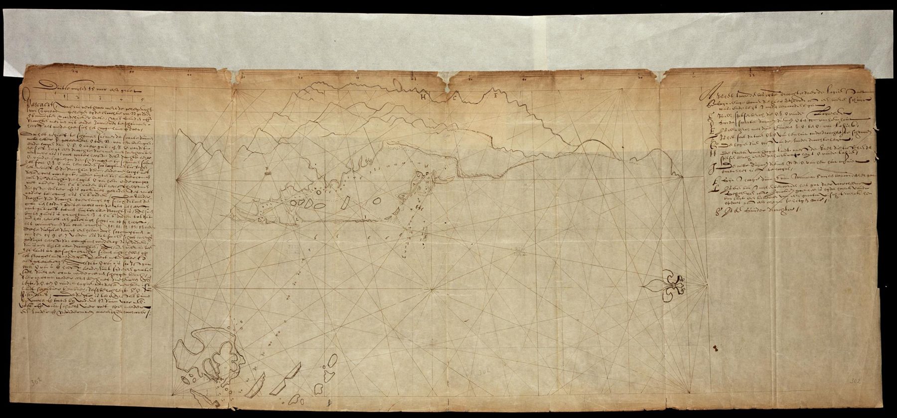
Chart of Tayouan, 1625 (Lootsman)
Heyndrick Ariensen Lootsman/荷蘭國家檔案館 (Nationaal Archief, Netherlands; Atlas of Mutual Heritage)/Wikimedia Commons・Public domain・典藏:荷蘭國家檔案館 VEL 302,AMH-4839;Leupe 目錄題名 Pascaert, waerin verthoont wort de gelegentheut van Tayouan
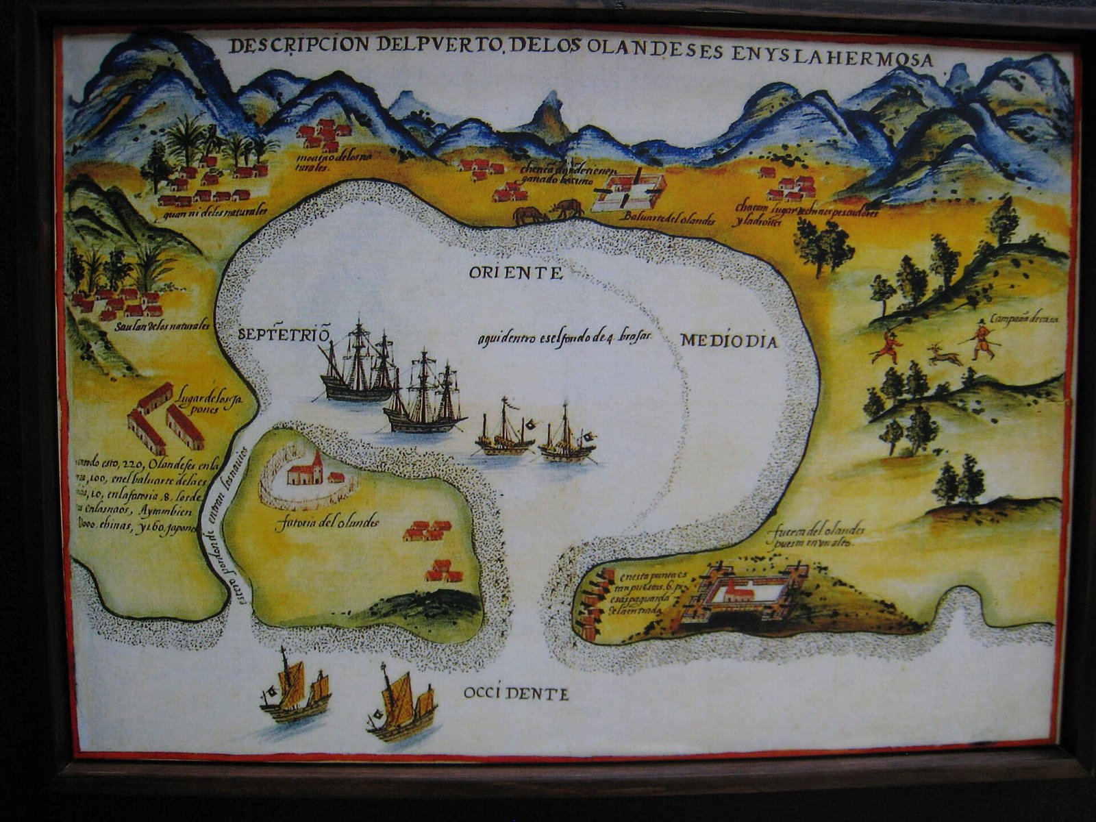
Dutch map of the port of Tayouan, 1626 (redrawn in Spain in the 18th century)
Jimmy Xu (Wikimedia Commons uploader; reproduction photograph)/Wikimedia Commons・Public domain・底圖為公共領域,本檔是展示用複製品的翻拍照片
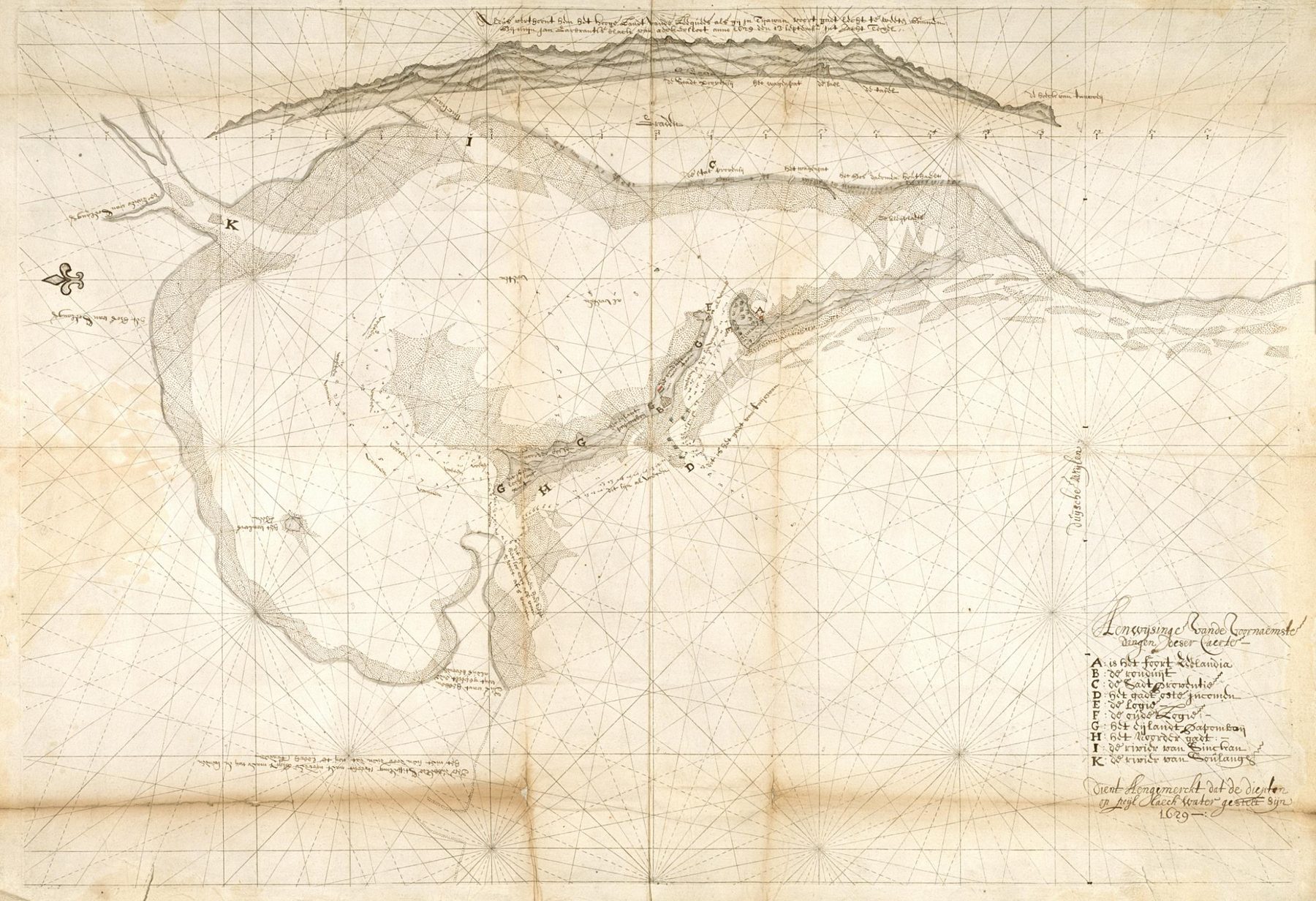
Coastal map of Tayouan, 1629: "Caerte van Teyouan"
Cartographer unknown/荷蘭國家檔案館 (Nationaal Archief, Netherlands; Atlas of Mutual Heritage)/Wikimedia Commons・Public domain・典藏:荷蘭國家檔案館 4.VELH 140,AMH-6415;繪者另有 Jan Gerbrantsz. Black 一說
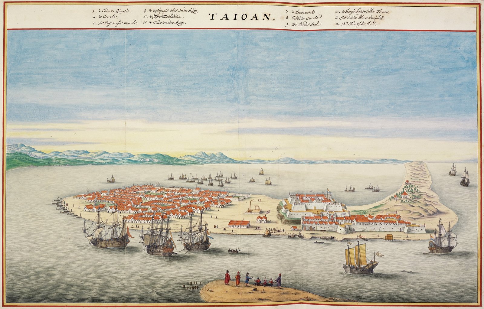
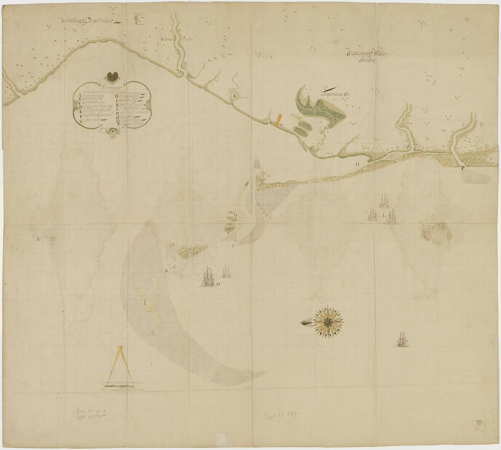
Tayouan (Taioan) waterway chart from the Blaeu–Van der Hem Atlas
Map of Fort Zeelandia and the Taijiang Inner Sea area, Dutch period
Partial signature on the map: "Cornelis ...ockey" (Plockhoy)/荷蘭國家檔案館 (Nationaal Archief, Netherlands; Atlas of Mutual Heritage)/Wikimedia Commons・Public domain・典藏:荷蘭國家檔案館 4.VELH 141.A(舊號 VELH0141_A),AMH-6416;背面題「Formosa 1652 / Een perfect caertjen vant Taijouanse canael」
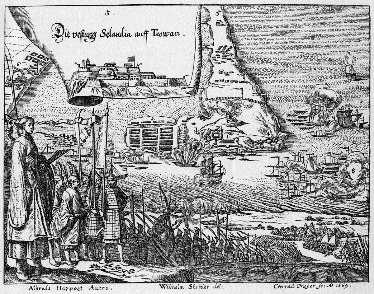
Copperplate engraving of Fort Zeelandia by Albrecht Herport, 1669
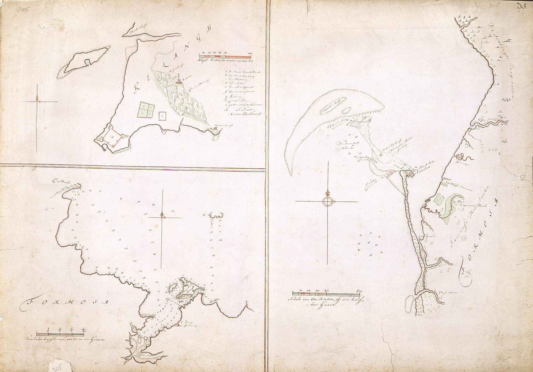
Map of Fort Zeelandia and the Tayouan channels (de Graaff)
Isaac de Graaff/荷蘭國家檔案館 (Nationaal Archief, Netherlands; Atlas of Mutual Heritage)/Wikimedia Commons・Public domain・典藏:荷蘭國家檔案館 VEL 305,AMH-2520;年代另有十七世紀、約 1695 年之說
Qing-period maps
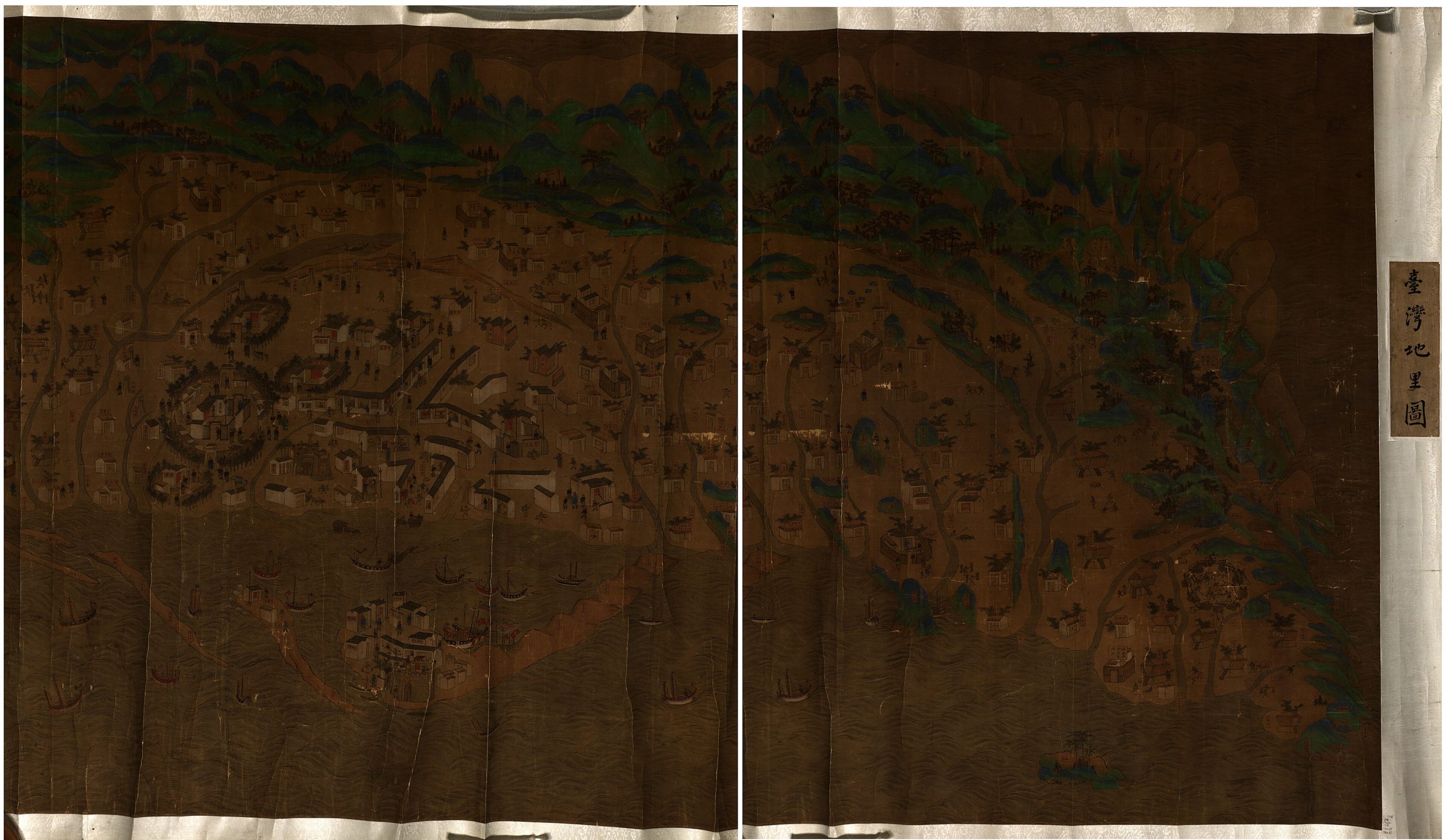
Taiwan dili tu (Map of the Geography of Taiwan), Kangxi reign, Qing dynasty
美國國會圖書館 (Library of Congress)/Wikimedia Commons・Public domain・典藏:美國國會圖書館 gm71005037;年代另有 1683 一說
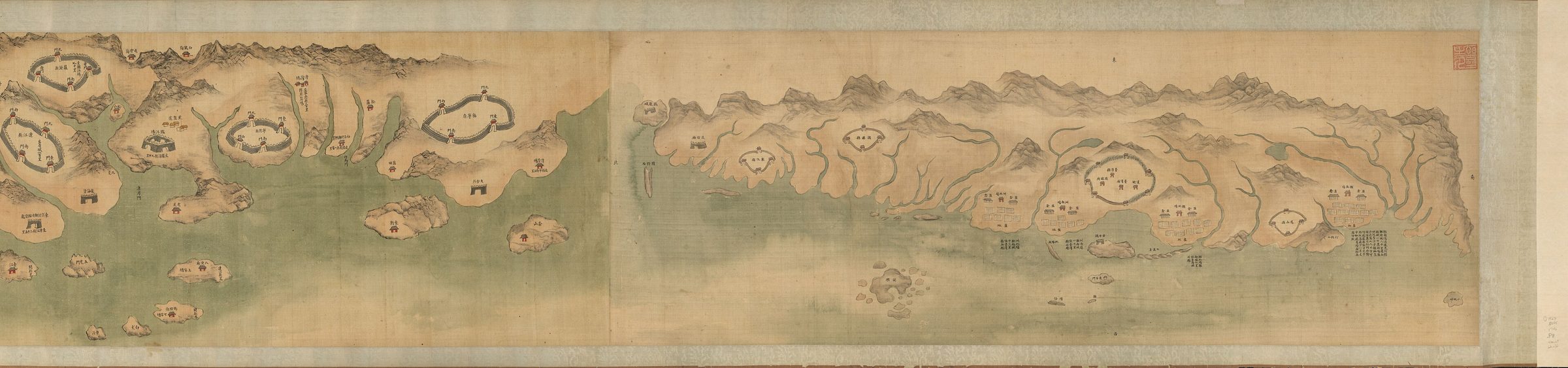
Minsheng yanchang quantu (Complete Map of the Salt Fields of Fujian Province), Qianlong reign
美國國會圖書館 (Library of Congress)/Wikimedia Commons・Public domain・典藏:美國國會圖書館 gm71005065
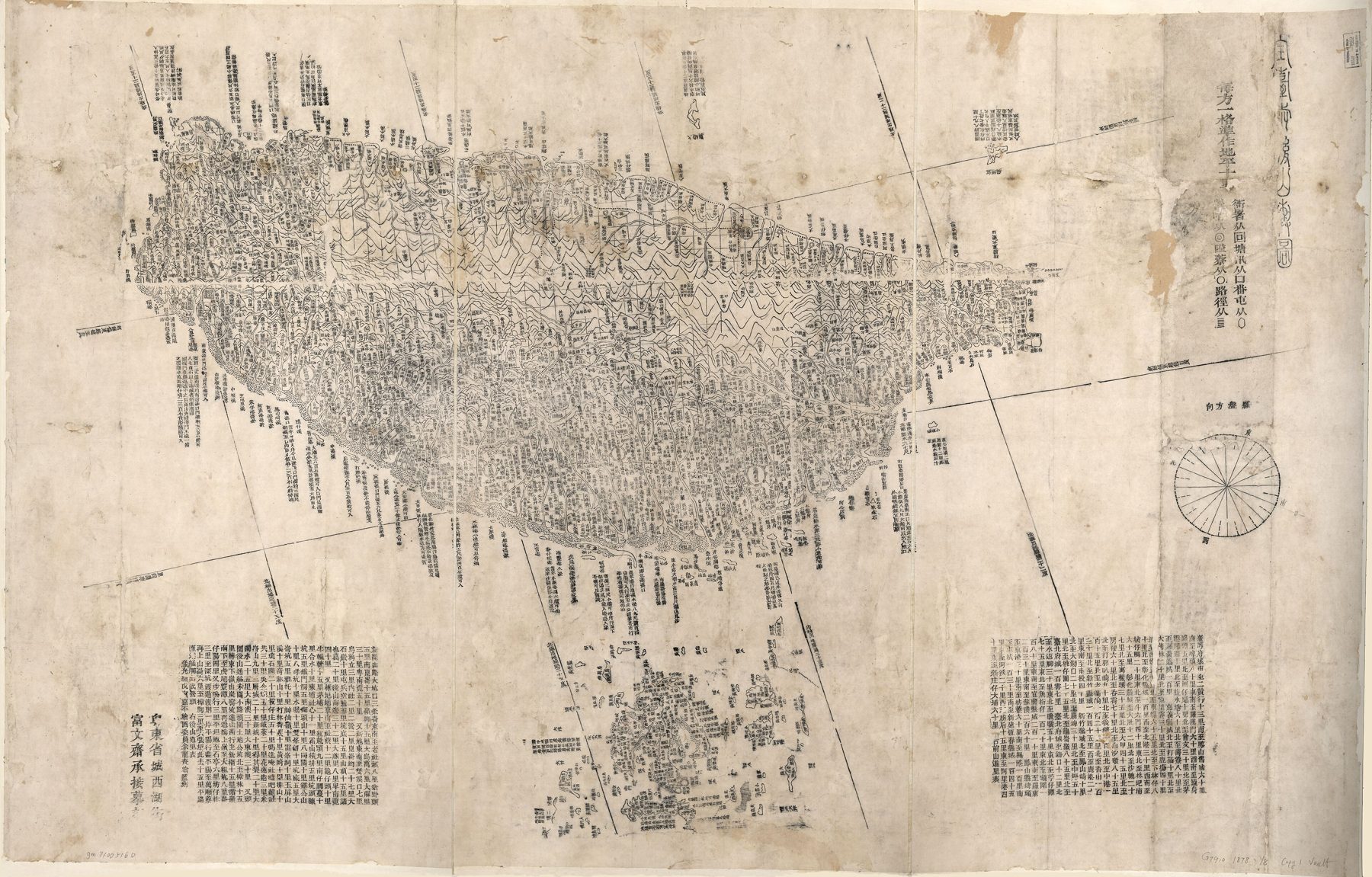
Quan Tai qianhoushan yutu (Map of the Front and Back Mountains of All Taiwan), Guangxu reign
美國國會圖書館 (Library of Congress)/Wikimedia Commons・Public domain・典藏:美國國會圖書館 gm71005160;與〈臺灣前後山全圖〉(gm71005066)是不同的兩張圖
Maps listed by link only
The image licenses of the following maps are unclear or limited to non-commercial use, so this site does not reproduce the images; please view them on the holding institution's website.
- 〈臺灣地圖〉 [Map of Taiwan] (Qianlong-era map of Taiwan, color on paper, 46 cm high, 667 cm wide), National Palace Museum. The museum states that researchers tend to date it to Qianlong 21–24 (1756–1759); the image license is unclear, so this site does not reproduce it.
- Jiang Yuanshu, 〈新建鹿耳門公館圖說〉 [Illustrated Account of the Newly Built Luermen Public Lodge], National Palace Museum. Marked as public domain on Wikimedia Commons, but the National Palace Museum's original page states all rights reserved; the license is unconfirmed, so this site does not reproduce it.
- 〈臺灣前後山全圖〉 [Complete Map of the Front and Back Mountains of Taiwan], Library of Congress gm71005066 (catalogued in the Academia Sinica Digital Atlas as A103000058). Digital Atlas images are restricted to personal and non-commercial use; this site has not yet obtained the Library of Congress original file.
- 康熙臺灣輿圖 [Kangxi Map of Taiwan], National Taiwan Museum. The museum's website offers online viewing; this site does not reproduce it.